

Brixental Tour
A cycling route starting in Reith bei Kitzbühel, Tyrol, Austria.
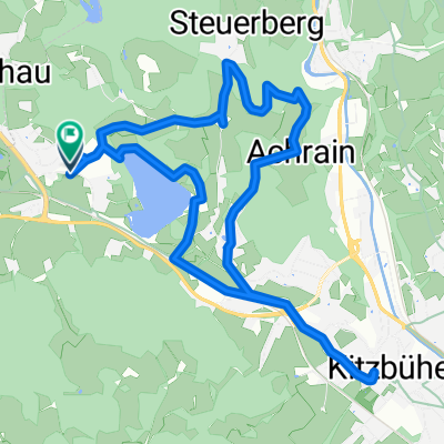
Overview
About this route
Leichte, familienfreundliche Strecke, mäßige Anstiege; vom Wörgler Boden auf Gemeindestraßen nach Hopfgarten; von hier abschnittsweise auf der Bundesstraße bis zum Almweg entlang der Windauer Ache zum Jägerhäusel und weiter nach Westendorf; auf Feldwegen und Nebenstraßen über Kirchberg zum Schwarzsee und Kitzbühel (Abzweigung nach Reith b. K.) Badeseen in Hopfgarten, Kirchberg und Kitzbühel. Anschluß an die RWW Söllandl und Leukental. Die Gesamtlänge dieser Route beträgt 39,7 km.
http://touren.kitzbuehel.com/de/tour/index/id/81_mountainbike
- -:--
- Duration
- 58.3 km
- Distance
- 825 m
- Ascent
- 812 m
- Descent
- ---
- Avg. speed
- 876 m
- Max. altitude

Route quality
Waytypes & surfaces along the route
Waytypes
Quiet road
22.7 km
(39 %)
Access road
22.4 km
(39 %)
Surfaces
Paved
53.1 km
(91 %)
Unpaved
3.5 km
(6 %)
Asphalt
52.2 km
(90 %)
Gravel
2 km
(3 %)
Continue with Bikemap
Use, edit, or download this cycling route
You would like to ride Brixental Tour or customize it for your own trip? Here is what you can do with this Bikemap route:
Free features
- Save this route as favorite or in collections
- Copy & plan your own version of this route
- Sync your route with Garmin or Wahoo
Premium features
Free trial for 3 days, or one-time payment. More about Bikemap Premium.
- Navigate this route on iOS & Android
- Export a GPX / KML file of this route
- Create your custom printout (try it for free)
- Download this route for offline navigation
Discover more Premium features.
Get Bikemap PremiumFrom our community
Other popular routes starting in Reith bei Kitzbühel
 Schwarzee über St.Johann auf den Harschbichl
- Distance
- 31.2 km
- Ascent
- 1,042 m
- Descent
- 1,036 m
- Location
- Reith bei Kitzbühel, Tyrol, Austria
 ITU Kitzbuhel 2012
- Distance
- 12.3 km
- Ascent
- 992 m
- Descent
- 91 m
- Location
- Reith bei Kitzbühel, Tyrol, Austria
 Reith um den Hartkaser
- Distance
- 50.5 km
- Ascent
- 438 m
- Descent
- 438 m
- Location
- Reith bei Kitzbühel, Tyrol, Austria
 Reith -Kitz - Oberndorf - Reith
- Distance
- 20.7 km
- Ascent
- 278 m
- Descent
- 277 m
- Location
- Reith bei Kitzbühel, Tyrol, Austria
 Rund um den Astberg
- Distance
- 18.5 km
- Ascent
- 674 m
- Descent
- 676 m
- Location
- Reith bei Kitzbühel, Tyrol, Austria
 Kitzbühel
- Distance
- 9.4 km
- Ascent
- 125 m
- Descent
- 124 m
- Location
- Reith bei Kitzbühel, Tyrol, Austria
 Der Weg zum Ochsen
- Distance
- 22.5 km
- Ascent
- 755 m
- Descent
- 667 m
- Location
- Reith bei Kitzbühel, Tyrol, Austria
 KB-Runde von MegO, bearbeitet
- Distance
- 13.5 km
- Ascent
- 335 m
- Descent
- 335 m
- Location
- Reith bei Kitzbühel, Tyrol, Austria
Open it in the app