

Bike Trail: Kitzbühel - Kirchberg
A cycling route starting in Kitzbühel, Tyrol, Austria.
Overview
About this route
Diese kurze Verbindung zwischen Kitzbühel und Kirchberg führt weiter zum Einstieg in den südlichen Teil des Bike Trail Tirol. Die Strecke führt ausschließlich auf asphaltiertem und fein geschottertem Radweg und stellt keine großen Ansprüche an Fahrtechnik und Kondition. Von Kirchberg aus kann man nun über die Filzenscharte weiter nach Neukirchen fahren oder in entgegen gesetzter Richtung über das Stangenjoch (mit GPS Daten problemlos). Ab Neukirchen im Pinzgau geht es dann über den Gerlospass wieder nach Tirol – siehe Etappe Neukirchen-Zell.
http://touren.kitzbuehel.com/de/tour/index/id/551_mountainbike
- -:--
- Duration
- 7.2 km
- Distance
- 70 m
- Ascent
- 23 m
- Descent
- ---
- Avg. speed
- 810 m
- Max. altitude

Route quality
Waytypes & surfaces along the route
Waytypes
Quiet road
5 km
(70 %)
Track
0.8 km
(12 %)
Surfaces
Paved
6.7 km
(93 %)
Unpaved
0.4 km
(6 %)
Asphalt
6.3 km
(88 %)
Paving stones
0.3 km
(5 %)
Continue with Bikemap
Use, edit, or download this cycling route
You would like to ride Bike Trail: Kitzbühel - Kirchberg or customize it for your own trip? Here is what you can do with this Bikemap route:
Free features
- Save this route as favorite or in collections
- Copy & plan your own version of this route
- Sync your route with Garmin or Wahoo
Premium features
Free trial for 3 days, or one-time payment. More about Bikemap Premium.
- Navigate this route on iOS & Android
- Export a GPX / KML file of this route
- Create your custom printout (try it for free)
- Download this route for offline navigation
Discover more Premium features.
Get Bikemap PremiumFrom our community
Other popular routes starting in Kitzbühel
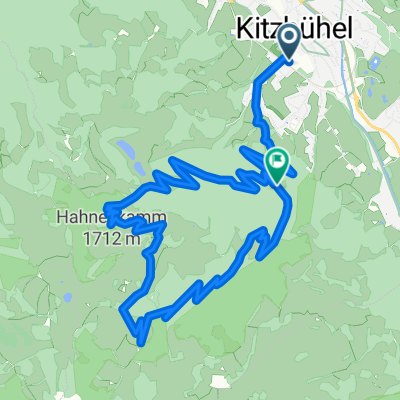 Hahnekamm
- Distance
- 13.6 km
- Ascent
- 892 m
- Descent
- 619 m
- Location
- Kitzbühel, Tyrol, Austria
 Kitzbuhel - Kitzbuhel 2
- Distance
- 58.7 km
- Ascent
- 1,170 m
- Descent
- 1,170 m
- Location
- Kitzbühel, Tyrol, Austria
 Aurach - Reith - Astberg - Ellmau - Oberndorf
- Distance
- 43.7 km
- Ascent
- 692 m
- Descent
- 692 m
- Location
- Kitzbühel, Tyrol, Austria
 Im Gries 11, Kitzbühel nach Im Gries 20, Kitzbühel
- Distance
- 68.1 km
- Ascent
- 964 m
- Descent
- 963 m
- Location
- Kitzbühel, Tyrol, Austria
 Kitzbuheler Horn
- Distance
- 48.1 km
- Ascent
- 1,504 m
- Descent
- 1,503 m
- Location
- Kitzbühel, Tyrol, Austria
 Kitzbuhel2_Hahnenkamm_Ashau_Kitz
- Distance
- 45.6 km
- Ascent
- 434 m
- Descent
- 1,320 m
- Location
- Kitzbühel, Tyrol, Austria
 Hannenkam-Kitzbühel-Leogang
- Distance
- 46.7 km
- Ascent
- 333 m
- Descent
- 1,163 m
- Location
- Kitzbühel, Tyrol, Austria
 Im Gries 11, Kitzbühel nach Im Gries 11, Kitzbühel
- Distance
- 59.6 km
- Ascent
- 1,836 m
- Descent
- 1,836 m
- Location
- Kitzbühel, Tyrol, Austria
Open it in the app