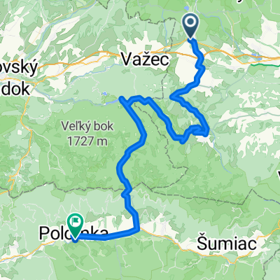
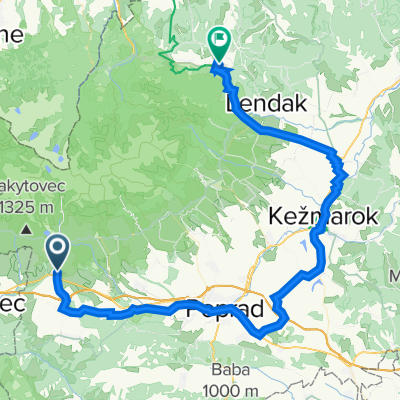
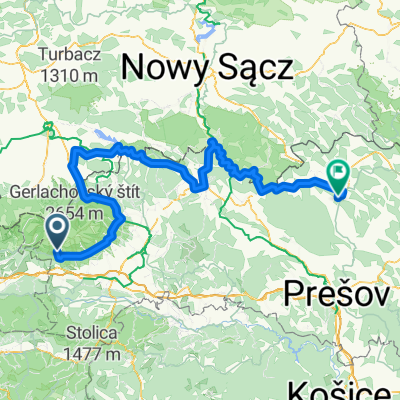
Bike 15 km Tatr. Štrba, Lieskovec - drevený most cez rieku Poprad
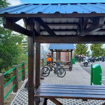
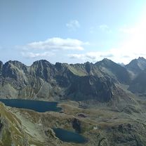
A cycling route starting in Strba, Prešov Region, Slovakia.
Overview
About this route
Tatr. Štrba, Lieskovec - E18 turnoff to SZM water station - hayloft - SZM water station - Tanap hut 24138 - end of 'asphalt road' - wooden bridge over the Poprad river - hut 24138 - turnoff to hayloft - horse paddock - turnoff to hayloft - hayloft - E18 turnoff to SZM water station - Tatr. Štrba, Lieskovec
- -:--
- Duration
- 11.2 km
- Distance
- 169 m
- Ascent
- 224 m
- Descent
- ---
- Avg. speed
- ---
- Max. altitude
Route quality
Waytypes & surfaces along the route
Waytypes
Track
8.3 km
(74 %)
Quiet road
0.3 km
(3 %)
Surfaces
Paved
7.6 km
(68 %)
Unpaved
2.9 km
(26 %)
Asphalt
7.6 km
(68 %)
Unpaved (undefined)
1.7 km
(15 %)
Continue with Bikemap
Use, edit, or download this cycling route
You would like to ride Bike 15 km Tatr. Štrba, Lieskovec - drevený most cez rieku Poprad or customize it for your own trip? Here is what you can do with this Bikemap route:
Free features
- Save this route as favorite or in collections
- Copy & plan your own version of this route
- Sync your route with Garmin or Wahoo
Premium features
Free trial for 3 days, or one-time payment. More about Bikemap Premium.
- Navigate this route on iOS & Android
- Export a GPX / KML file of this route
- Create your custom printout (try it for free)
- Download this route for offline navigation
Discover more Premium features.
Get Bikemap PremiumFrom our community
Other popular routes starting in Strba
Hlavná do Hlavná- Distance
- 7 km
- Ascent
- 65 m
- Descent
- 115 m
- Location
- Strba, Prešov Region, Slovakia
Strbske_Bardejov- Distance
- 207.2 km
- Ascent
- 1,294 m
- Descent
- 2,197 m
- Location
- Strba, Prešov Region, Slovakia
Hřebenovka Nízké Tatry & Velká Fatra - Den 7. -Andrejcová - Telgárt (pěšky)- Distance
- 15.8 km
- Ascent
- 756 m
- Descent
- 1,271 m
- Location
- Strba, Prešov Region, Slovakia
Štrba - Heľpa - Polomka- Distance
- 67.3 km
- Ascent
- 1,024 m
- Descent
- 1,344 m
- Location
- Strba, Prešov Region, Slovakia
Wokół Tatr Day 3- Distance
- 69.6 km
- Ascent
- 756 m
- Descent
- 792 m
- Location
- Strba, Prešov Region, Slovakia
L.Teplička - Veľká Vápenica - Panská hoľa - L.Teplička- Distance
- 32.3 km
- Ascent
- 987 m
- Descent
- 987 m
- Location
- Strba, Prešov Region, Slovakia
Štrba to Spišská Nová Ves- Distance
- 62.8 km
- Ascent
- 721 m
- Descent
- 1,164 m
- Location
- Strba, Prešov Region, Slovakia
Bike 68 km Štrbské Pleso - Liptovský Mikuláš a okolie- Distance
- 65.4 km
- Ascent
- 208 m
- Descent
- 964 m
- Location
- Strba, Prešov Region, Slovakia
Open it in the app


