

23. ARTOUR 2020
A cycling route starting in Heidenau, Saxony, Germany.
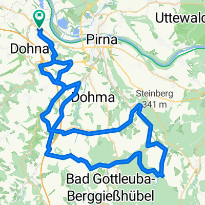
Overview
About this route
Tour Familie: Dresden – Lungkwitz – Dresden / 20 km (160 Hm)
Leicht ansteigendes Profil. Für Kinder ab 8 Jahren gut geeignet.
Tour A: Dresden – Reinhardtsgrimma – Dresden / 30 km (250 Hm)
Leicht ansteigendes Profil. Traumhafte Landschaft entlang des Lockwitzbaches mit Ortsdurchfahrt Kreischa.
Tour B: Dresden – Oberfrauendorf – Dresden / 45 km (510 Hm)
Im zweiten Teil der Strecke wartet „Der steile Kanten“. Landschaftlich wunderschön, aber schweißtreibend.
Tour C: Dresden – Hirschsprung – Dresden / 65 km (740 Hm)
Entspanntes Radfahren auf der Hochwaldstraße im Schmiedeberger Hochwald entschädigt für die Strapazen in Oberfrauendorf. Zusätzliches Highlight ist der Anstieg in der Bobbahn.
Tour D: Dresden – Altenberg – Dresden / 100 km (1.500 Hm)
Im letzten Teil der Strecke geht es noch einmal ordentlich auf und ab. NEU: 35 km Strecke entlang der tschechischen Grenze mit atemberaubenden Blicken. Ab Hirschsprung geht es dann rasant bergab bis nach Dresden.
- -:--
- Duration
- 95.4 km
- Distance
- 1,088 m
- Ascent
- 1,088 m
- Descent
- ---
- Avg. speed
- ---
- Max. altitude
Route quality
Waytypes & surfaces along the route
Waytypes
Busy road
57.8 km
(61 %)
Road
16.6 km
(17 %)
Surfaces
Paved
79.8 km
(84 %)
Unpaved
0.3 km
(<1 %)
Asphalt
78.6 km
(82 %)
Paving stones
1.2 km
(1 %)
Route highlights
Points of interest along the route
Point of interest after 9.7 km
Streckenposten Lungkwitz Wendepunkt Tour Familie / 20 km-Strecke
Point of interest after 45.6 km
Streckenposten Müglitz Tour D / 100 km - Strecke
Point of interest after 65.2 km
Streckenposten Hirschsprung Wendepunkt Tour C / 64 km-Strecke
Point of interest after 73.8 km
Streckenposten Hochwaldstraße Wendepunkt Tour B / 44 km-Strecke
Point of interest after 81.1 km
Streckenposten Reinhardtsgrimma Wendepunkt Tour A / 30 km-Strecke
Continue with Bikemap
Use, edit, or download this cycling route
You would like to ride 23. ARTOUR 2020 or customize it for your own trip? Here is what you can do with this Bikemap route:
Free features
- Save this route as favorite or in collections
- Copy & plan your own version of this route
- Split it into stages to create a multi-day tour
- Sync your route with Garmin or Wahoo
Premium features
Free trial for 3 days, or one-time payment. More about Bikemap Premium.
- Navigate this route on iOS & Android
- Export a GPX / KML file of this route
- Create your custom printout (try it for free)
- Download this route for offline navigation
Discover more Premium features.
Get Bikemap PremiumFrom our community
Other popular routes starting in Heidenau
 tourX
tourX- Distance
- 39.6 km
- Ascent
- 517 m
- Descent
- 572 m
- Location
- Heidenau, Saxony, Germany
 Borsberg 013-1226hm
- Distance
- 42.3 km
- Ascent
- 0 m
- Descent
- 0 m
- Location
- Heidenau, Saxony, Germany
 Wehlen - Hocksteinschänke - Stolpen - Hochland
- Distance
- 67.1 km
- Ascent
- 530 m
- Descent
- 375 m
- Location
- Heidenau, Saxony, Germany
 33. Heidenauer RTF 20.09.2014 - 60km -
- Distance
- 56.2 km
- Ascent
- 655 m
- Descent
- 656 m
- Location
- Heidenau, Saxony, Germany
 33. Heidenauer RTF 20.09.2014 - 120 km
- Distance
- 114.6 km
- Ascent
- 900 m
- Descent
- 901 m
- Location
- Heidenau, Saxony, Germany
 30. Heidenauer RTF 17.09.2011 - 120 km
- Distance
- 119 km
- Ascent
- 955 m
- Descent
- 955 m
- Location
- Heidenau, Saxony, Germany
 Pillnitz-LIEBETHALER GRUND-BRAND-Rathen-Zschachwitz
- Distance
- 64.4 km
- Ascent
- 558 m
- Descent
- 551 m
- Location
- Heidenau, Saxony, Germany
 Schnelle Ausfahrt vom 28.07.17, 18:38
- Distance
- 7.9 km
- Ascent
- 16 m
- Descent
- 16 m
- Location
- Heidenau, Saxony, Germany
Open it in the app