

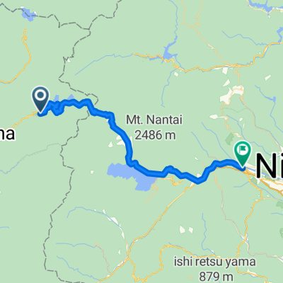
Minakami Echigoyuzawa
A cycling route starting in Numata, Gunma, Japan.
Overview
About this route
- -:--
- Duration
- 51.6 km
- Distance
- 1,438 m
- Ascent
- 1,449 m
- Descent
- ---
- Avg. speed
- ---
- Max. altitude

Continue with Bikemap
Use, edit, or download this cycling route
You would like to ride Minakami Echigoyuzawa or customize it for your own trip? Here is what you can do with this Bikemap route:
Free features
- Save this route as favorite or in collections
- Copy & plan your own version of this route
- Sync your route with Garmin or Wahoo
Premium features
Free trial for 3 days, or one-time payment. More about Bikemap Premium.
- Navigate this route on iOS & Android
- Export a GPX / KML file of this route
- Create your custom printout (try it for free)
- Download this route for offline navigation
Discover more Premium features.
Get Bikemap PremiumFrom our community
Other popular routes starting in Numata
 210824丸沼高原
- Distance
- 87.5 km
- Ascent
- 2,573 m
- Descent
- 2,573 m
- Location
- Numata, Gunma, Japan
 CJ19 沼田~奥日光(2016)
- Distance
- 44.7 km
- Ascent
- 1,400 m
- Descent
- 496 m
- Location
- Numata, Gunma, Japan
 2017/5/28栗原川林道
- Distance
- 61.7 km
- Ascent
- 1,357 m
- Descent
- 1,357 m
- Location
- Numata, Gunma, Japan
 CJ19 沼田~奥日光(2016)
- Distance
- 70.7 km
- Ascent
- 1,335 m
- Descent
- 1,391 m
- Location
- Numata, Gunma, Japan
 616_Mina_PC1
- Distance
- 133.7 km
- Ascent
- 2,297 m
- Descent
- 2,506 m
- Location
- Numata, Gunma, Japan
 2016Tour-Marunuma
- Distance
- 46.5 km
- Ascent
- 731 m
- Descent
- 1,504 m
- Location
- Numata, Gunma, Japan
 2016Tour-Numata2
- Distance
- 92.1 km
- Ascent
- 1,773 m
- Descent
- 1,573 m
- Location
- Numata, Gunma, Japan
 栗原川林道
栗原川林道- Distance
- 91.2 km
- Ascent
- 1,517 m
- Descent
- 1,516 m
- Location
- Numata, Gunma, Japan
Open it in the app