

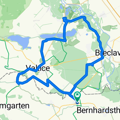
Bernhardsthal - Wien/Copacagrana
A cycling route starting in Bernhardsthal, Lower Austria, Austria.
Overview
About this route
- -:--
- Duration
- 85.9 km
- Distance
- 243 m
- Ascent
- 244 m
- Descent
- ---
- Avg. speed
- ---
- Max. altitude
Route quality
Waytypes & surfaces along the route
Waytypes
Quiet road
33.5 km
(39 %)
Track
18.9 km
(22 %)
Surfaces
Paved
71.3 km
(83 %)
Unpaved
2.6 km
(3 %)
Asphalt
61.9 km
(72 %)
Paved (undefined)
9.5 km
(11 %)
Continue with Bikemap
Use, edit, or download this cycling route
You would like to ride Bernhardsthal - Wien/Copacagrana or customize it for your own trip? Here is what you can do with this Bikemap route:
Free features
- Save this route as favorite or in collections
- Copy & plan your own version of this route
- Split it into stages to create a multi-day tour
- Sync your route with Garmin or Wahoo
Premium features
Free trial for 3 days, or one-time payment. More about Bikemap Premium.
- Navigate this route on iOS & Android
- Export a GPX / KML file of this route
- Create your custom printout (try it for free)
- Download this route for offline navigation
Discover more Premium features.
Get Bikemap PremiumFrom our community
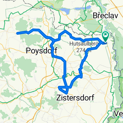
Other popular routes starting in Bernhardsthal
 Lundenburger Bundesstraße nach Lundenburger Bundesstraße
- Distance
- 45.9 km
- Ascent
- 401 m
- Descent
- 400 m
- Location
- Bernhardsthal, Lower Austria, Austria
 BHT - Steinberg - Landman - BHT
- Distance
- 90.5 km
- Ascent
- 905 m
- Descent
- 846 m
- Location
- Bernhardsthal, Lower Austria, Austria
 Bernhardsthal - Wien/Copacagrana
- Distance
- 85.9 km
- Ascent
- 243 m
- Descent
- 244 m
- Location
- Bernhardsthal, Lower Austria, Austria
 Bernharsdsthal-Lednice
- Distance
- 43.9 km
- Ascent
- 193 m
- Descent
- 192 m
- Location
- Bernhardsthal, Lower Austria, Austria
 Schulstraße nach Schulstraße
- Distance
- 66.5 km
- Ascent
- 457 m
- Descent
- 456 m
- Location
- Bernhardsthal, Lower Austria, Austria
 Bernhardsthal Bahnhof nach Marchegg Bahnhof (Vorplatz)
- Distance
- 62.6 km
- Ascent
- 76 m
- Descent
- 97 m
- Location
- Bernhardsthal, Lower Austria, Austria
 GA1 mittel: BHT <-> Marchegg
- Distance
- 105.1 km
- Ascent
- 178 m
- Descent
- 183 m
- Location
- Bernhardsthal, Lower Austria, Austria
 Thayatalradln
- Distance
- 61.4 km
- Ascent
- 209 m
- Descent
- 208 m
- Location
- Bernhardsthal, Lower Austria, Austria
Open it in the app