

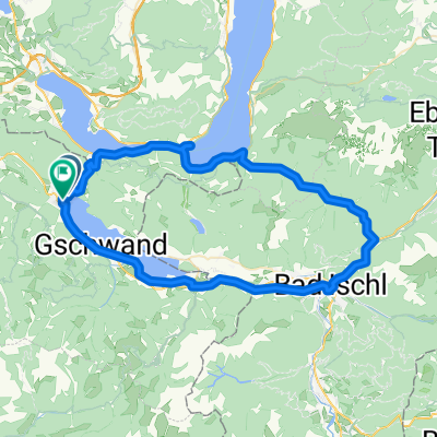
Bad Ischl
A cycling route starting in St. Gilgen, Salzburg, Austria.
Overview
About this route
- -:--
- Duration
- 25.5 km
- Distance
- 239 m
- Ascent
- 329 m
- Descent
- ---
- Avg. speed
- ---
- Max. altitude

Continue with Bikemap
Use, edit, or download this cycling route
You would like to ride Bad Ischl or customize it for your own trip? Here is what you can do with this Bikemap route:
Free features
- Save this route as favorite or in collections
- Copy & plan your own version of this route
- Sync your route with Garmin or Wahoo
Premium features
Free trial for 3 days, or one-time payment. More about Bikemap Premium.
- Navigate this route on iOS & Android
- Export a GPX / KML file of this route
- Create your custom printout (try it for free)
- Download this route for offline navigation
Discover more Premium features.
Get Bikemap PremiumFrom our community
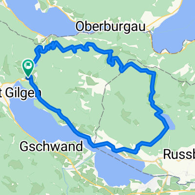
Other popular routes starting in St. Gilgen
 Bad Ischl
- Distance
- 25.5 km
- Ascent
- 239 m
- Descent
- 329 m
- Location
- St. Gilgen, Salzburg, Austria
 dan 2-St.Gilgen-Ebensee-B
- Distance
- 100.5 km
- Ascent
- 1,600 m
- Descent
- 1,725 m
- Location
- St. Gilgen, Salzburg, Austria
 Attersee Runde
- Distance
- 68.9 km
- Ascent
- 1,089 m
- Descent
- 1,159 m
- Location
- St. Gilgen, Salzburg, Austria
 Mondsee Straße nach Schwarzenbrunnerstraße
- Distance
- 64.8 km
- Ascent
- 1,532 m
- Descent
- 1,535 m
- Location
- St. Gilgen, Salzburg, Austria
 St. Gilgen to Hallstatt
- Distance
- 42.5 km
- Ascent
- 205 m
- Descent
- 215 m
- Location
- St. Gilgen, Salzburg, Austria
 30 Almen Tour - 2. Etappe
- Distance
- 54.2 km
- Ascent
- 1,761 m
- Descent
- 1,897 m
- Location
- St. Gilgen, Salzburg, Austria
 Ein Mal um den Schafberg_Schwarzensee- Wolfgangsee- Eisenaueralm CLONED FROM ROUTE 1712510
- Distance
- 31.7 km
- Ascent
- 1,101 m
- Descent
- 1,102 m
- Location
- St. Gilgen, Salzburg, Austria
 Salzkammergut Tour 3
- Distance
- 80.1 km
- Ascent
- 354 m
- Descent
- 354 m
- Location
- St. Gilgen, Salzburg, Austria
Open it in the app