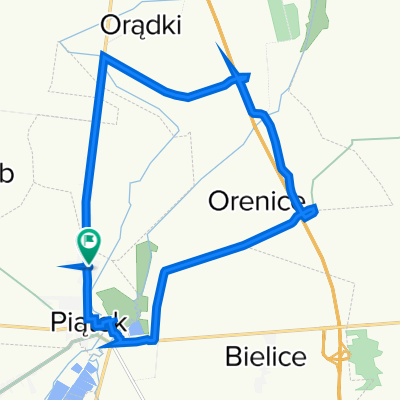
Tour de Los 2018
A cycling route starting in Gmina Piątek, Łódź Voivodeship, Poland.
Overview
About this route
Piątek (Polska) - Avizieniai (Litwa)
- -:--
- Duration
- 1,926.6 km
- Distance
- 811 m
- Ascent
- 800 m
- Descent
- ---
- Avg. speed
- ---
- Max. altitude
Route quality
Waytypes & surfaces along the route
Waytypes
Busy road
771.1 km
(40 %)
Road
438.6 km
(23 %)
Surfaces
Paved
1,359.9 km
(71 %)
Unpaved
125.2 km
(6 %)
Asphalt
1,253.2 km
(65 %)
Unpaved (undefined)
73.9 km
(4 %)
Route highlights
Points of interest along the route
Accommodation after 118.9 km
1 nocleg
Accommodation after 236.7 km
2 nocleg
Accommodation after 395.7 km
nocleg 3
Accommodation after 509.5 km
nocleg 4
Accommodation after 616.1 km
nocleg 5
Accommodation after 719 km
nocleg 6
Accommodation after 824.2 km
nocleg 7
Accommodation after 916.2 km
nocleg 8
Accommodation after 977.4 km
nocleg 9
Accommodation after 1,095.3 km
nocleg 10
Accommodation after 1,147.2 km
nocleg 11
Accommodation after 1,306.7 km
nocleg 12
Accommodation after 1,415.8 km
nocleg 13
Accommodation after 1,547.7 km
nocleg 14
Accommodation after 1,669.3 km
nocleg 15
Accommodation after 1,772.1 km
nocleg 16
Accommodation after 1,811.1 km
nocleg 17
Point of interest after 1,913.1 km
META
Continue with Bikemap
Use, edit, or download this cycling route
You would like to ride Tour de Los 2018 or customize it for your own trip? Here is what you can do with this Bikemap route:
Free features
- Save this route as favorite or in collections
- Copy & plan your own version of this route
- Split it into stages to create a multi-day tour
- Sync your route with Garmin or Wahoo
Premium features
Free trial for 3 days, or one-time payment. More about Bikemap Premium.
- Navigate this route on iOS & Android
- Export a GPX / KML file of this route
- Create your custom printout (try it for free)
- Download this route for offline navigation
Discover more Premium features.
Get Bikemap PremiumFrom our community
Other popular routes starting in Gmina Piątek
- Trasa wycieczki rowerowej historyczno-krajobrazowa^^
- Distance
- 23.9 km
- Ascent
- 24 m
- Descent
- 26 m
- Location
- Gmina Piątek, Łódź Voivodeship, Poland
- Starych Drzew
- Distance
- 50.8 km
- Ascent
- 82 m
- Descent
- 81 m
- Location
- Gmina Piątek, Łódź Voivodeship, Poland
- Kutnowska 68, Piątek do Kutnowska 66, Piątek
- Distance
- 18.7 km
- Ascent
- 63 m
- Descent
- 78 m
- Location
- Gmina Piątek, Łódź Voivodeship, Poland
- 28A, Oszkowice do Piaski Bankowe
- Distance
- 16.9 km
- Ascent
- 4 m
- Descent
- 0 m
- Location
- Gmina Piątek, Łódź Voivodeship, Poland
- Piątek-sobota-piątek
- Distance
- 53.3 km
- Ascent
- 38 m
- Descent
- 38 m
- Location
- Gmina Piątek, Łódź Voivodeship, Poland
- Kutnowska 68, Piątek do Kutnowska 70, Piątek
- Distance
- 16.1 km
- Ascent
- 65 m
- Descent
- 65 m
- Location
- Gmina Piątek, Łódź Voivodeship, Poland
- Tama wodna w lesie przy Głównej w Giecznie
- Distance
- 23.6 km
- Ascent
- 76 m
- Descent
- 77 m
- Location
- Gmina Piątek, Łódź Voivodeship, Poland
- Tour de Los 2018
- Distance
- 1,926.6 km
- Ascent
- 811 m
- Descent
- 800 m
- Location
- Gmina Piątek, Łódź Voivodeship, Poland
Open it in the app