

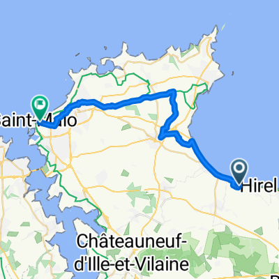
F05c inkorting via Tour de Manche
A cycling route starting in Hirel, Brittany Region, France.
Overview
About this route
F05c inkorting via Tour de Manche
- -:--
- Duration
- 8.5 km
- Distance
- 15 m
- Ascent
- 14 m
- Descent
- ---
- Avg. speed
- ---
- Max. altitude
Route quality
Waytypes & surfaces along the route
Waytypes
Busy road
4.4 km
(52 %)
Quiet road
1.7 km
(20 %)
Surfaces
Paved
6.9 km
(81 %)
Unpaved
1.5 km
(18 %)
Asphalt
6.9 km
(81 %)
Gravel
1.4 km
(17 %)
Continue with Bikemap
Use, edit, or download this cycling route
You would like to ride F05c inkorting via Tour de Manche or customize it for your own trip? Here is what you can do with this Bikemap route:
Free features
- Save this route as favorite or in collections
- Copy & plan your own version of this route
- Sync your route with Garmin or Wahoo
Premium features
Free trial for 3 days, or one-time payment. More about Bikemap Premium.
- Navigate this route on iOS & Android
- Export a GPX / KML file of this route
- Create your custom printout (try it for free)
- Download this route for offline navigation
Discover more Premium features.
Get Bikemap PremiumFrom our community
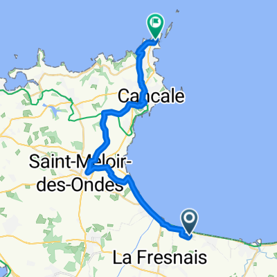
Other popular routes starting in Hirel
 2 La Bruyère, Hirel à 66 Rue de Dol, La Fresnais
- Distance
- 1.1 km
- Ascent
- 0 m
- Descent
- 0 m
- Location
- Hirel, Brittany Region, France
 4 Rue Auguste Pinson, Hirel à La Chapelle-Saint-Aubert
- Distance
- 67.9 km
- Ascent
- 539 m
- Descent
- 472 m
- Location
- Hirel, Brittany Region, France
 Hirel nach Avenue Louis Martin, Saint-Malo
- Distance
- 24.4 km
- Ascent
- 88 m
- Descent
- 89 m
- Location
- Hirel, Brittany Region, France
 1-Hirel - Saint-Malo
- Distance
- 31.5 km
- Ascent
- 186 m
- Descent
- 158 m
- Location
- Hirel, Brittany Region, France
 F05c inkorting via Tour de Manche
- Distance
- 8.5 km
- Ascent
- 15 m
- Descent
- 14 m
- Location
- Hirel, Brittany Region, France
 Route van Hirel
- Distance
- 20.5 km
- Ascent
- 90 m
- Descent
- 61 m
- Location
- Hirel, Brittany Region, France
 De Rue du Bord de Mer 95, Hirel à Le Châtel 9, Saint-Broladre
- Distance
- 28 km
- Ascent
- 169 m
- Descent
- 155 m
- Location
- Hirel, Brittany Region, France
 13 Le Fédeuil, Hirel à Dol-de-Bretagne
- Distance
- 5.6 km
- Ascent
- 18 m
- Descent
- 4 m
- Location
- Hirel, Brittany Region, France
Open it in the app