

Combe Laval
A cycling route starting in Saint-Just-de-Claix, Auvergne-Rhône-Alpes, France.
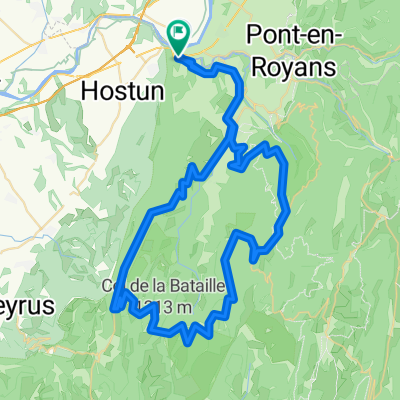
Overview
About this route
- -:--
- Duration
- 109.2 km
- Distance
- 1,557 m
- Ascent
- 1,560 m
- Descent
- ---
- Avg. speed
- ---
- Max. altitude

Route quality
Waytypes & surfaces along the route
Waytypes
Quiet road
16.4 km
(15 %)
Road
3.3 km
(3 %)
Surfaces
Paved
81.9 km
(75 %)
Unpaved
1.1 km
(1 %)
Asphalt
80.8 km
(74 %)
Paved (undefined)
1.1 km
(1 %)
Continue with Bikemap
Use, edit, or download this cycling route
You would like to ride Combe Laval or customize it for your own trip? Here is what you can do with this Bikemap route:
Free features
- Save this route as favorite or in collections
- Copy & plan your own version of this route
- Split it into stages to create a multi-day tour
- Sync your route with Garmin or Wahoo
Premium features
Free trial for 3 days, or one-time payment. More about Bikemap Premium.
- Navigate this route on iOS & Android
- Export a GPX / KML file of this route
- Create your custom printout (try it for free)
- Download this route for offline navigation
Discover more Premium features.
Get Bikemap PremiumFrom our community
Other popular routes starting in Saint-Just-de-Claix
 Combe Laval - Bataille
- Distance
- 79.4 km
- Ascent
- 2,424 m
- Descent
- 2,373 m
- Location
- Saint-Just-de-Claix, Auvergne-Rhône-Alpes, France
 Col de Toutes Aures-Presles-Malleval
- Distance
- 56.8 km
- Ascent
- 1,674 m
- Descent
- 1,650 m
- Location
- Saint-Just-de-Claix, Auvergne-Rhône-Alpes, France
 col de la chau par les gorges de la bourne
- Distance
- 91.2 km
- Ascent
- 1,548 m
- Descent
- 1,541 m
- Location
- Saint-Just-de-Claix, Auvergne-Rhône-Alpes, France
 14. Tag Sint Nazare en Royans- Grenoble
- Distance
- 102 km
- Ascent
- 1,185 m
- Descent
- 1,151 m
- Location
- Saint-Just-de-Claix, Auvergne-Rhône-Alpes, France
 Etapa 082B (Saint Nazaire en Royans - Le Bourg d'Oisans)
- Distance
- 151.4 km
- Ascent
- 2,783 m
- Descent
- 2,226 m
- Location
- Saint-Just-de-Claix, Auvergne-Rhône-Alpes, France
 tour de l`avenir stage 5 itt
- Distance
- 29.8 km
- Ascent
- 393 m
- Descent
- 276 m
- Location
- Saint-Just-de-Claix, Auvergne-Rhône-Alpes, France
 Vercors 2
- Distance
- 59.1 km
- Ascent
- 1,254 m
- Descent
- 1,227 m
- Location
- Saint-Just-de-Claix, Auvergne-Rhône-Alpes, France
 Saint-Nazaire-en-Royans - Col de la Machine - Col du Pionier
- Distance
- 46.4 km
- Ascent
- 1,511 m
- Descent
- 1,435 m
- Location
- Saint-Just-de-Claix, Auvergne-Rhône-Alpes, France
Open it in the app