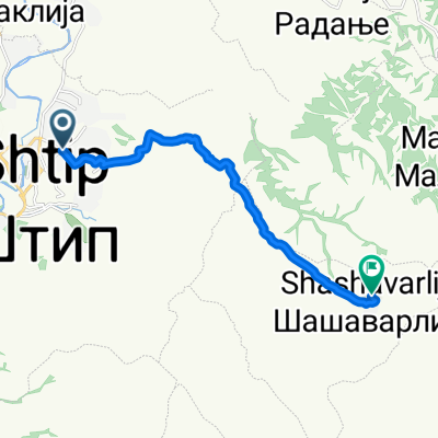
Stip to Zrnovci trailhead
A cycling route starting in Shtip, Opština Štip, Macedonia.
Overview
About this route
Directions to hiking trailhead. From there, 25 min. hike on foot to a swiming hole along the creek that runs through the canyon.
- -:--
- Duration
- 33.5 km
- Distance
- 284 m
- Ascent
- 189 m
- Descent
- ---
- Avg. speed
- ---
- Avg. speed
Route quality
Waytypes & surfaces along the route
Waytypes
Road
27.6 km
(82 %)
Quiet road
2.4 km
(7 %)
Surfaces
Paved
6.9 km
(21 %)
Unpaved
3.3 km
(10 %)
Paved (undefined)
4.2 km
(13 %)
Unpaved (undefined)
3.3 km
(10 %)
Continue with Bikemap
Use, edit, or download this cycling route
You would like to ride Stip to Zrnovci trailhead or customize it for your own trip? Here is what you can do with this Bikemap route:
Free features
- Save this route as favorite or in collections
- Copy & plan your own version of this route
- Sync your route with Garmin or Wahoo
Premium features
Free trial for 3 days, or one-time payment. More about Bikemap Premium.
- Navigate this route on iOS & Android
- Export a GPX / KML file of this route
- Create your custom printout (try it for free)
- Download this route for offline navigation
Discover more Premium features.
Get Bikemap PremiumFrom our community
Other popular routes starting in Shtip
- Den na proleta 2016
- Distance
- 56.8 km
- Ascent
- 894 m
- Descent
- 922 m
- Location
- Shtip, Opština Štip, Macedonia
- Ванѓина чешма, Љуботен to Balkanska Road, Штип
- Distance
- 18.2 km
- Ascent
- 237 m
- Descent
- 499 m
- Location
- Shtip, Opština Štip, Macedonia
- Stip-s.Ljoboten
- Distance
- 8.4 km
- Ascent
- 263 m
- Descent
- 60 m
- Location
- Shtip, Opština Štip, Macedonia
- Nova ruta za den na proleta
- Distance
- 42.8 km
- Ascent
- 665 m
- Descent
- 665 m
- Location
- Shtip, Opština Štip, Macedonia
- Po patot so Oblacite
- Distance
- 85.3 km
- Ascent
- 587 m
- Descent
- 585 m
- Location
- Shtip, Opština Štip, Macedonia
- Штип - Баргала - Штип
- Distance
- 16.7 km
- Ascent
- 183 m
- Descent
- 86 m
- Location
- Shtip, Opština Štip, Macedonia
- Stip to Zrnovci trailhead
- Distance
- 33.5 km
- Ascent
- 284 m
- Descent
- 189 m
- Location
- Shtip, Opština Štip, Macedonia
- Kruzna Stip Radovis Stip
- Distance
- 105 km
- Ascent
- 1,456 m
- Descent
- 1,425 m
- Location
- Shtip, Opština Štip, Macedonia
Open it in the app