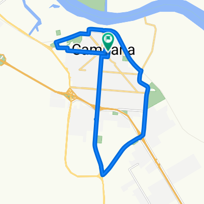
Otamendi - Zárate
A cycling route starting in Campana, Buenos Aires, Argentina.
Overview
About this route
De Otamendi a Zárate por caminos rurales de las islas del Delta del Paraná
- -:--
- Duration
- 69.8 km
- Distance
- 67 m
- Ascent
- 51 m
- Descent
- ---
- Avg. speed
- ---
- Avg. speed
Route quality
Waytypes & surfaces along the route
Waytypes
Undefined
69.8 km
(100 %)
Surfaces
Undefined
69.8 km
(100 %)
Route highlights
Points of interest along the route
Point of interest after 5.5 km
RĂo Paraná de las Palmas
Point of interest after 13.1 km
Arroyo Las Piedras
Point of interest after 25.8 km
RĂo Carabelas
Point of interest after 26.2 km
Canal Alem
Point of interest after 26.4 km
Recreo Blondeau
Point of interest after 43.9 km
RĂo Paraná GuazĂş
Point of interest after 43.9 km
Puente Urquiza
Point of interest after 47.8 km
Km. 103
Point of interest after 48.6 km
TĂşnel
Point of interest after 63.1 km
Puente Mitre
Point of interest after 66 km
Cruce con FCGU
Continue with Bikemap
Use, edit, or download this cycling route
You would like to ride Otamendi - Zárate or customize it for your own trip? Here is what you can do with this Bikemap route:
Free features
- Save this route as favorite or in collections
- Copy & plan your own version of this route
- Sync your route with Garmin or Wahoo
Premium features
Free trial for 3 days, or one-time payment. More about Bikemap Premium.
- Navigate this route on iOS & Android
- Export a GPX / KML file of this route
- Create your custom printout (try it for free)
- Download this route for offline navigation
Discover more Premium features.
Get Bikemap PremiumFrom our community
Other popular routes starting in Campana
- CONTRAPEDAL: Otamendi Zarate
- Distance
- 69.7 km
- Ascent
- 54 m
- Descent
- 42 m
- Location
- Campana, Buenos Aires, Argentina
- Delta - En grupo- A recreo Blondeau
- Distance
- 48.9 km
- Ascent
- 62 m
- Descent
- 64 m
- Location
- Campana, Buenos Aires, Argentina
- Otamendi Recreo Blondeau
- Distance
- 25.4 km
- Ascent
- 54 m
- Descent
- 60 m
- Location
- Campana, Buenos Aires, Argentina
- Campana-San Andrés de Giles-Capilla del Señor
- Distance
- 124 km
- Ascent
- 109 m
- Descent
- 91 m
- Location
- Campana, Buenos Aires, Argentina
- Seba
- Distance
- 53.8 km
- Ascent
- 82 m
- Descent
- 82 m
- Location
- Campana, Buenos Aires, Argentina
- 15Km Con Bajadas
- Distance
- 15.2 km
- Ascent
- 36 m
- Descent
- 39 m
- Location
- Campana, Buenos Aires, Argentina
- A Recreo Blondeau
- Distance
- 48.9 km
- Ascent
- 57 m
- Descent
- 60 m
- Location
- Campana, Buenos Aires, Argentina
- Cycle for Heart 2010, Campana to Ramallo
- Distance
- 140.4 km
- Ascent
- 125 m
- Descent
- 119 m
- Location
- Campana, Buenos Aires, Argentina