

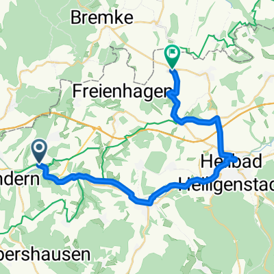
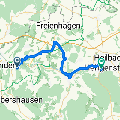
Leine-Werra- Radweg
A cycling route starting in Marth, Thuringia, Germany.
Overview
About this route
Uder bis Witzenhausen
- -:--
- Duration
- 17.7 km
- Distance
- 247 m
- Ascent
- 300 m
- Descent
- ---
- Avg. speed
- ---
- Max. altitude

Route quality
Waytypes & surfaces along the route
Waytypes
Quiet road
6.4 km
(36 %)
Track
3.7 km
(21 %)
Surfaces
Paved
9.4 km
(53 %)
Unpaved
1.6 km
(9 %)
Asphalt
8.1 km
(46 %)
Ground
1.3 km
(7 %)
Continue with Bikemap
Use, edit, or download this cycling route
You would like to ride Leine-Werra- Radweg or customize it for your own trip? Here is what you can do with this Bikemap route:
Free features
- Save this route as favorite or in collections
- Copy & plan your own version of this route
- Sync your route with Garmin or Wahoo
Premium features
Free trial for 3 days, or one-time payment. More about Bikemap Premium.
- Navigate this route on iOS & Android
- Export a GPX / KML file of this route
- Create your custom printout (try it for free)
- Download this route for offline navigation
Discover more Premium features.
Get Bikemap PremiumFrom our community
Other popular routes starting in Marth
 Am Anger 11, Marth nach B446, Seulingen
- Distance
- 52.2 km
- Ascent
- 2,112 m
- Descent
- 2,211 m
- Location
- Marth, Thuringia, Germany
 Steady ride in Uder
- Distance
- 6.6 km
- Ascent
- 34 m
- Descent
- 14 m
- Location
- Marth, Thuringia, Germany
 Heilbad Heiligenstadt
- Distance
- 22.1 km
- Ascent
- 265 m
- Descent
- 146 m
- Location
- Marth, Thuringia, Germany
 Leinerunde 4: Miwepa - Mollenfelde - Miwepa
- Distance
- 47.5 km
- Ascent
- 514 m
- Descent
- 516 m
- Location
- Marth, Thuringia, Germany
 Straße Ohne Straßennamen nach Goethestraße
- Distance
- 19.3 km
- Ascent
- 226 m
- Descent
- 209 m
- Location
- Marth, Thuringia, Germany
 Gerade Fahrt in Marth
- Distance
- 25.2 km
- Ascent
- 350 m
- Descent
- 332 m
- Location
- Marth, Thuringia, Germany
 Leine-Werra- Radweg
- Distance
- 17.7 km
- Ascent
- 247 m
- Descent
- 300 m
- Location
- Marth, Thuringia, Germany
 Rangeraktion - Rusteberg nach Hanstein
- Distance
- 10.4 km
- Ascent
- 260 m
- Descent
- 264 m
- Location
- Marth, Thuringia, Germany
Open it in the app