

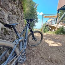
Giro Monte Amiata
A cycling route starting in Abbadia San Salvatore, Tuscany, Italy.
Overview
About this route
Giro Monte Amiata
- -:--
- Duration
- 35 km
- Distance
- 959 m
- Ascent
- 962 m
- Descent
- ---
- Avg. speed
- ---
- Max. altitude

Route quality
Waytypes & surfaces along the route
Waytypes
Track
16.8 km
(48 %)
Road
7.3 km
(21 %)
Surfaces
Paved
5.6 km
(16 %)
Unpaved
21.3 km
(61 %)
Gravel
8.7 km
(25 %)
Ground
8.4 km
(24 %)
Continue with Bikemap
Use, edit, or download this cycling route
You would like to ride Giro Monte Amiata or customize it for your own trip? Here is what you can do with this Bikemap route:
Free features
- Save this route as favorite or in collections
- Copy & plan your own version of this route
- Sync your route with Garmin or Wahoo
Premium features
Free trial for 3 days, or one-time payment. More about Bikemap Premium.
- Navigate this route on iOS & Android
- Export a GPX / KML file of this route
- Create your custom printout (try it for free)
- Download this route for offline navigation
Discover more Premium features.
Get Bikemap PremiumFrom our community
Other popular routes starting in Abbadia San Salvatore
 Amiata FreeRide
- Distance
- 32.1 km
- Ascent
- 1,758 m
- Descent
- 2,516 m
- Location
- Abbadia San Salvatore, Tuscany, Italy
 Vivo-Renai-Ferro-C.Piano-Seggiano-Altore-Ermicciolo
- Distance
- 41.8 km
- Ascent
- 1,100 m
- Descent
- 1,100 m
- Location
- Abbadia San Salvatore, Tuscany, Italy
 04-08-2019
- Distance
- 39.9 km
- Ascent
- 1,036 m
- Descent
- 1,035 m
- Location
- Abbadia San Salvatore, Tuscany, Italy
 Firenze - Bolsena 3/4
- Distance
- 49.8 km
- Ascent
- 798 m
- Descent
- 1,013 m
- Location
- Abbadia San Salvatore, Tuscany, Italy
 MRnordahletape6
- Distance
- 138 km
- Ascent
- 1,153 m
- Descent
- 1,755 m
- Location
- Abbadia San Salvatore, Tuscany, Italy
 Giro Monte Amiata
- Distance
- 35 km
- Ascent
- 959 m
- Descent
- 962 m
- Location
- Abbadia San Salvatore, Tuscany, Italy
 giro amiata da bagni san filippo + radicofani
- Distance
- 85 km
- Ascent
- 2,044 m
- Descent
- 2,022 m
- Location
- Abbadia San Salvatore, Tuscany, Italy
 Abbadia san Salvatore - Montalcino
- Distance
- 48.3 km
- Ascent
- 811 m
- Descent
- 1,104 m
- Location
- Abbadia San Salvatore, Tuscany, Italy
Open it in the app