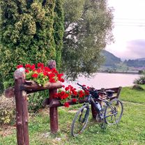
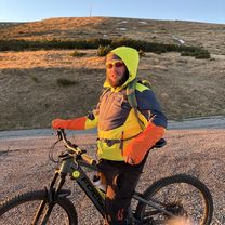
slovensky raj
A cycling route starting in Dobšiná, Košice Region, Slovakia.
Overview
About this route
okruh masa spisska
- -:--
- Duration
- 76.4 km
- Distance
- 1,002 m
- Ascent
- 1,016 m
- Descent
- ---
- Avg. speed
- ---
- Max. altitude
Route quality
Waytypes & surfaces along the route
Waytypes
Road
29 km
(38 %)
Quiet road
5.3 km
(7 %)
Surfaces
Paved
39.7 km
(52 %)
Unpaved
0.8 km
(1 %)
Asphalt
39.7 km
(52 %)
Ground
0.8 km
(1 %)
Undefined
35.9 km
(47 %)
Continue with Bikemap
Use, edit, or download this cycling route
You would like to ride slovensky raj or customize it for your own trip? Here is what you can do with this Bikemap route:
Free features
- Save this route as favorite or in collections
- Copy & plan your own version of this route
- Sync your route with Garmin or Wahoo
Premium features
Free trial for 3 days, or one-time payment. More about Bikemap Premium.
- Navigate this route on iOS & Android
- Export a GPX / KML file of this route
- Create your custom printout (try it for free)
- Download this route for offline navigation
Discover more Premium features.
Get Bikemap PremiumFrom our community
Other popular routes starting in Dobšiná
- Telgart- Dobšiná- Dobš. ľad jask- Telgárt
- Distance
- 51.8 km
- Ascent
- 1,029 m
- Descent
- 1,039 m
- Location
- Dobšiná, Košice Region, Slovakia
- Iglói kör
- Distance
- 64.7 km
- Ascent
- 958 m
- Descent
- 957 m
- Location
- Dobšiná, Košice Region, Slovakia
- Šumiac, Kráľová Hoľa, Bartková,Pohorelá Šumiac
- Distance
- 39.1 km
- Ascent
- 1,338 m
- Descent
- 1,337 m
- Location
- Dobšiná, Košice Region, Slovakia
- Telgárt, Telgárt až Muráň
- Distance
- 21.6 km
- Ascent
- 667 m
- Descent
- 694 m
- Location
- Dobšiná, Košice Region, Slovakia
- SK/Telgárt - PL/Zakopane
- Distance
- 98.8 km
- Ascent
- 1,877 m
- Descent
- 1,820 m
- Location
- Dobšiná, Košice Region, Slovakia
- Zelená stuha Horehronia
- Distance
- 54.8 km
- Ascent
- 979 m
- Descent
- 1,246 m
- Location
- Dobšiná, Košice Region, Slovakia
- KH-Certovica
- Distance
- 42 km
- Ascent
- 1,110 m
- Descent
- 1,803 m
- Location
- Dobšiná, Košice Region, Slovakia
- Kráľova Hoľa
- Distance
- 23.8 km
- Ascent
- 1,024 m
- Descent
- 1,009 m
- Location
- Dobšiná, Košice Region, Slovakia
Open it in the app