

Col de la Croix / Lucelle
A cycling route starting in Courgenay, Canton of Jura, Switzerland.
Overview
About this route
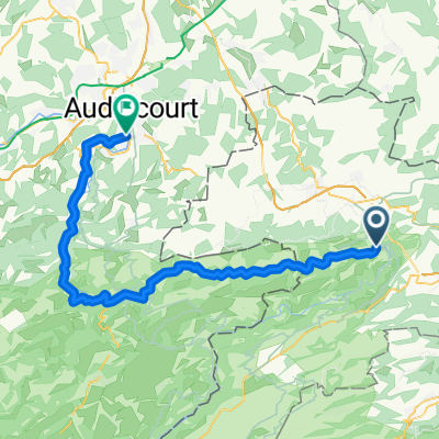
A very beautiful tour from Sainte-Ursanne to Laufen. With a pleasant climb, it goes up to the Col de la Croix and then through the southern Ajoie to Lucelle. Then follows a very enjoyable descent along the Lucelle stream, constantly switching between the Swiss and French sides until the Laufental valley. From Laufen, the S-Bahn takes us back to Saint-Ursanne without changing trains.
- -:--
- Duration
- 47.7 km
- Distance
- 506 m
- Ascent
- 646 m
- Descent
- ---
- Avg. speed
- ---
- Max. altitude
Route quality
Waytypes & surfaces along the route
Waytypes
Quiet road
10 km
(21 %)
Road
7.6 km
(16 %)
Surfaces
Paved
18.1 km
(38 %)
Unpaved
0.5 km
(1 %)
Asphalt
15.7 km
(33 %)
Concrete
1.4 km
(3 %)
Continue with Bikemap
Use, edit, or download this cycling route
You would like to ride Col de la Croix / Lucelle or customize it for your own trip? Here is what you can do with this Bikemap route:
Free features
- Save this route as favorite or in collections
- Copy & plan your own version of this route
- Sync your route with Garmin or Wahoo
Premium features
Free trial for 3 days, or one-time payment. More about Bikemap Premium.
- Navigate this route on iOS & Android
- Export a GPX / KML file of this route
- Create your custom printout (try it for free)
- Download this route for offline navigation
Discover more Premium features.
Get Bikemap PremiumFrom our community
Other popular routes starting in Courgenay
 day 2
day 2- Distance
- 60 km
- Ascent
- 964 m
- Descent
- 1,074 m
- Location
- Courgenay, Canton of Jura, Switzerland
 Col de la Croix / Lucelle
- Distance
- 47.7 km
- Ascent
- 506 m
- Descent
- 646 m
- Location
- Courgenay, Canton of Jura, Switzerland
 Entlang dem Doubs und zur Ajoie
- Distance
- 42.4 km
- Ascent
- 457 m
- Descent
- 480 m
- Location
- Courgenay, Canton of Jura, Switzerland
 Col-de-la-Croix - Laufen
- Distance
- 47.2 km
- Ascent
- 545 m
- Descent
- 638 m
- Location
- Courgenay, Canton of Jura, Switzerland
 Courgenay - Porrentruy
- Distance
- 55.4 km
- Ascent
- 325 m
- Descent
- 385 m
- Location
- Courgenay, Canton of Jura, Switzerland
 Rue de Petite-Gilberte 2, Courgenay nach Enge Gasse 10, Laufen
- Distance
- 39.8 km
- Ascent
- 310 m
- Descent
- 489 m
- Location
- Courgenay, Canton of Jura, Switzerland
 St-Ursanne - Bordeaux
- Distance
- 1,138.8 km
- Ascent
- 1,561 m
- Descent
- 1,592 m
- Location
- Courgenay, Canton of Jura, Switzerland
 Rue de Petite Gilberte 2, Courgenay nach Bahnhofstrasse 30, Laufen
- Distance
- 140.9 km
- Ascent
- 773 m
- Descent
- 905 m
- Location
- Courgenay, Canton of Jura, Switzerland
Open it in the app