
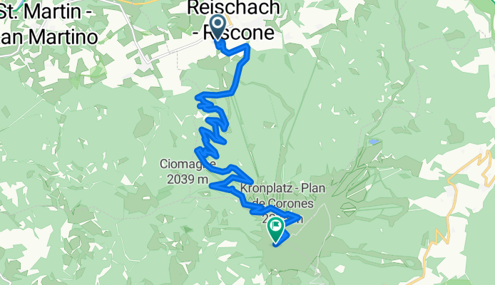
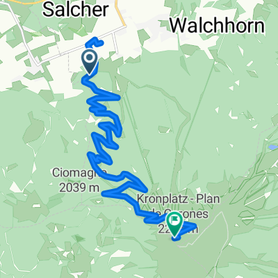
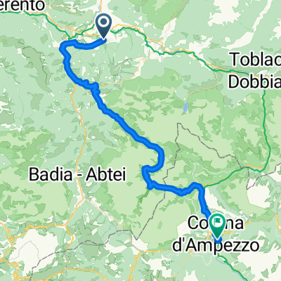
plan de corones
A cycling route starting in Riscone, Trentino-Alto Adige, Italy.
Overview
About this route
- 3 h 8 min
- Duration
- 14.3 km
- Distance
- 3,166 m
- Ascent
- 1,850 m
- Descent
- 4.6 km/h
- Avg. speed
- ---
- Max. altitude

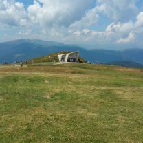
Route photos

Continue with Bikemap
Use, edit, or download this cycling route
You would like to ride plan de corones or customize it for your own trip? Here is what you can do with this Bikemap route:
Free features
- Save this route as favorite or in collections
- Copy & plan your own version of this route
- Sync your route with Garmin or Wahoo
Premium features
Free trial for 3 days, or one-time payment. More about Bikemap Premium.
- Navigate this route on iOS & Android
- Export a GPX / KML file of this route
- Create your custom printout (try it for free)
- Download this route for offline navigation
Discover more Premium features.
Get Bikemap PremiumFrom our community
Other popular routes starting in Riscone
 Reischach - Dürrensteiner Hütte
- Distance
- 48.6 km
- Ascent
- 1,506 m
- Descent
- 481 m
- Location
- Riscone, Trentino-Alto Adige, Italy
 Kronplatzumrundung...
- Distance
- 43.4 km
- Ascent
- 1,352 m
- Descent
- 1,349 m
- Location
- Riscone, Trentino-Alto Adige, Italy
 Riscone - Plan
- Distance
- 13.7 km
- Ascent
- 1,427 m
- Descent
- 224 m
- Location
- Riscone, Trentino-Alto Adige, Italy
 Bruneck Kronplatzrunde
- Distance
- 67.6 km
- Ascent
- 1,425 m
- Descent
- 1,413 m
- Location
- Riscone, Trentino-Alto Adige, Italy
 plan de corones
- Distance
- 14.3 km
- Ascent
- 3,166 m
- Descent
- 1,850 m
- Location
- Riscone, Trentino-Alto Adige, Italy
 Reischach nach Weizgruber Alm
- Distance
- 33.1 km
- Ascent
- 1,451 m
- Descent
- 386 m
- Location
- Riscone, Trentino-Alto Adige, Italy
 Riscone_Casteldarne
- Distance
- 12.6 km
- Ascent
- 185 m
- Descent
- 319 m
- Location
- Riscone, Trentino-Alto Adige, Italy
 Von Bruneck bis Cortina d'Ampezzo
- Distance
- 58.2 km
- Ascent
- 2,185 m
- Descent
- 1,928 m
- Location
- Riscone, Trentino-Alto Adige, Italy
Open it in the app