

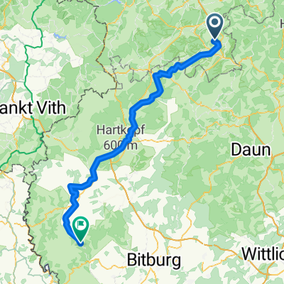
Tondorf-Schuld-Tondorf
A cycling route starting in Ohlenhard, Rhineland-Palatinate, Germany.
Overview
About this route
- -:--
- Duration
- 52.4 km
- Distance
- 441 m
- Ascent
- 441 m
- Descent
- ---
- Avg. speed
- ---
- Max. altitude
Route quality
Waytypes & surfaces along the route
Waytypes
Busy road
28.1 km
(54 %)
Road
9.8 km
(19 %)
Surfaces
Paved
32.1 km
(61 %)
Unpaved
3.1 km
(6 %)
Asphalt
30.8 km
(59 %)
Unpaved (undefined)
1.5 km
(3 %)
Continue with Bikemap
Use, edit, or download this cycling route
You would like to ride Tondorf-Schuld-Tondorf or customize it for your own trip? Here is what you can do with this Bikemap route:
Free features
- Save this route as favorite or in collections
- Copy & plan your own version of this route
- Sync your route with Garmin or Wahoo
Premium features
Free trial for 3 days, or one-time payment. More about Bikemap Premium.
- Navigate this route on iOS & Android
- Export a GPX / KML file of this route
- Create your custom printout (try it for free)
- Download this route for offline navigation
Discover more Premium features.
Get Bikemap PremiumFrom our community
Other popular routes starting in Ohlenhard
 14Eif3Waimes80
- Distance
- 79 km
- Ascent
- 731 m
- Descent
- 634 m
- Location
- Ohlenhard, Rhineland-Palatinate, Germany
 14Eif3Waimes80
- Distance
- 79 km
- Ascent
- 730 m
- Descent
- 633 m
- Location
- Ohlenhard, Rhineland-Palatinate, Germany
 Am Freilinger See 300, Blankenheim nach Am Freilinger See 300, Blankenheim
- Distance
- 26.4 km
- Ascent
- 486 m
- Descent
- 494 m
- Location
- Ohlenhard, Rhineland-Palatinate, Germany
 Freilinger See Rückfahrt
- Distance
- 96.9 km
- Ascent
- 276 m
- Descent
- 632 m
- Location
- Ohlenhard, Rhineland-Palatinate, Germany
 Blankenheim nach Oberstraße, Neuerburg
- Distance
- 79.7 km
- Ascent
- 972 m
- Descent
- 1,104 m
- Location
- Ohlenhard, Rhineland-Palatinate, Germany
 Bachgeflüster
- Distance
- 31.3 km
- Ascent
- 479 m
- Descent
- 479 m
- Location
- Ohlenhard, Rhineland-Palatinate, Germany
 Tagestour Freilingen
- Distance
- 50.2 km
- Ascent
- 620 m
- Descent
- 623 m
- Location
- Ohlenhard, Rhineland-Palatinate, Germany
 Freilingersee
- Distance
- 36.7 km
- Ascent
- 427 m
- Descent
- 426 m
- Location
- Ohlenhard, Rhineland-Palatinate, Germany
Open it in the app