

新營太子宮回家
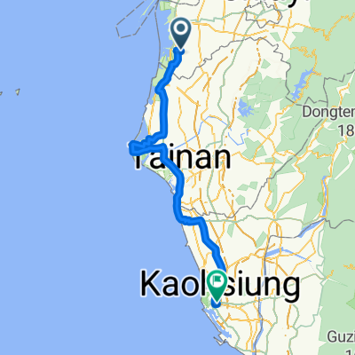
A cycling route starting in Xinying District, Taiwan, Taiwan.
Overview
About this route
- 6 min
- Duration
- 3.5 km
- Distance
- 117 m
- Ascent
- 109 m
- Descent
- 33.3 km/h
- Avg. speed
- ---
- Max. altitude

Route quality
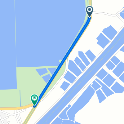
Waytypes & surfaces along the route
Waytypes
Road
2.9 km
(85 %)
Access road
0.5 km
(14 %)
Undefined
0 km
(1 %)
Continue with Bikemap
Use, edit, or download this cycling route
You would like to ride 新營太子宮回家 or customize it for your own trip? Here is what you can do with this Bikemap route:
Free features
- Save this route as favorite or in collections
- Copy & plan your own version of this route
- Sync your route with Garmin or Wahoo
Premium features
Free trial for 3 days, or one-time payment. More about Bikemap Premium.
- Navigate this route on iOS & Android
- Export a GPX / KML file of this route
- Create your custom printout (try it for free)
- Download this route for offline navigation
Discover more Premium features.
Get Bikemap PremiumFrom our community
Other popular routes starting in Xinying District
 冬山咖啡節4+2
- Distance
- 19 km
- Ascent
- 347 m
- Descent
- 162 m
- Location
- Xinying District, Taiwan, Taiwan
 1XXKM
1XXKM- Distance
- 117.8 km
- Ascent
- 1,034 m
- Descent
- 1,043 m
- Location
- Xinying District, Taiwan, Taiwan
 咖啡公路
咖啡公路- Distance
- 88.8 km
- Ascent
- 1,403 m
- Descent
- 1,395 m
- Location
- Xinying District, Taiwan, Taiwan
 Day 4
Day 4- Distance
- 126 km
- Ascent
- 68 m
- Descent
- 58 m
- Location
- Xinying District, Taiwan, Taiwan
 Day 4 鹽水 高雄市
- Distance
- 101.3 km
- Ascent
- 90 m
- Descent
- 91 m
- Location
- Xinying District, Taiwan, Taiwan
 小騎一段路
小騎一段路- Distance
- 6.8 km
- Ascent
- 233 m
- Descent
- 245 m
- Location
- Xinying District, Taiwan, Taiwan
 Xinying District - Xinying District
- Distance
- 0.8 km
- Ascent
- 0 m
- Descent
- 0 m
- Location
- Xinying District, Taiwan, Taiwan
 Tour 台南後壁 - 高雄 (實騎版)
- Distance
- 132.4 km
- Ascent
- 772 m
- Descent
- 789 m
- Location
- Xinying District, Taiwan, Taiwan
Open it in the app