

Triple Crown
David's Attempt at the Triple Crown
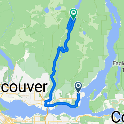
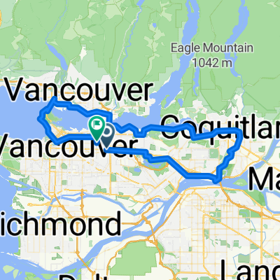
A cycling route starting in Burnaby, British Columbia, Canada.
Overview
About this route
Park at Seymour but cycle towards Cypress along Marine Drive and climb up Cypress Mountain first, Grouse Mountain second, stay high and come down Mountain Hwy and tackle Seymour Mountain last; come down the mountain to your parked vehicle
- -:--
- Duration
- 99.5 km
- Distance
- 2,194 m
- Ascent
- 2,194 m
- Descent
- ---
- Avg. speed
- ---
- Max. altitude

Part of
Triple Crown
1 stage
Route quality
Waytypes & surfaces along the route
Waytypes
Road
56.7 km
(57 %)
Quiet road
10.9 km
(11 %)
Surfaces
Paved
69.7 km
(70 %)
Asphalt
49.8 km
(50 %)
Paved (undefined)
18.9 km
(19 %)
Continue with Bikemap
Use, edit, or download this cycling route
You would like to ride David's Attempt at the Triple Crown or customize it for your own trip? Here is what you can do with this Bikemap route:
Free features
- Save this route as favorite or in collections
- Copy & plan your own version of this route
- Split it into stages to create a multi-day tour
- Sync your route with Garmin or Wahoo
Premium features
Free trial for 3 days, or one-time payment. More about Bikemap Premium.
- Navigate this route on iOS & Android
- Export a GPX / KML file of this route
- Create your custom printout (try it for free)
- Download this route for offline navigation
Discover more Premium features.
Get Bikemap PremiumFrom our community
Other popular routes starting in Burnaby
 Route in Burnaby
- Distance
- 9.8 km
- Ascent
- 175 m
- Descent
- 68 m
- Location
- Burnaby, British Columbia, Canada
 NB Deep Cove Rd @ Badger Rd to Seymour Valley Trailway
- Distance
- 33.7 km
- Ascent
- 818 m
- Descent
- 652 m
- Location
- Burnaby, British Columbia, Canada
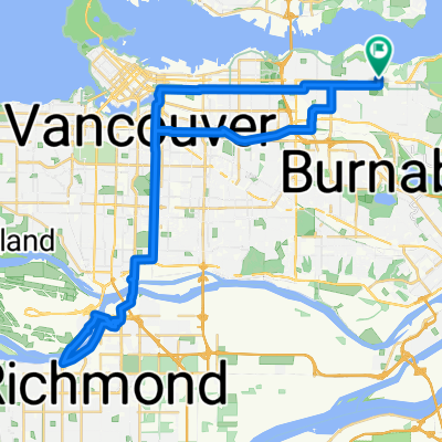 Route to Burnaby
- Distance
- 51.1 km
- Ascent
- 429 m
- Descent
- 427 m
- Location
- Burnaby, British Columbia, Canada
 Camano Street to Kingsway
- Distance
- 4.6 km
- Ascent
- 72 m
- Descent
- 22 m
- Location
- Burnaby, British Columbia, Canada
 4730 Lougheed Hwy, Burnaby to 21298 36 Ave, Langley
- Distance
- 41.2 km
- Ascent
- 357 m
- Descent
- 340 m
- Location
- Burnaby, British Columbia, Canada
 CentralPark to Foreshore
- Distance
- 12.6 km
- Ascent
- 119 m
- Descent
- 165 m
- Location
- Burnaby, British Columbia, Canada
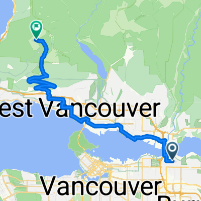 From Burnaby to West Vancouver
- Distance
- 33.4 km
- Ascent
- 1,116 m
- Descent
- 278 m
- Location
- Burnaby, British Columbia, Canada
 Seven Cities - 50k
- Distance
- 78.9 km
- Ascent
- 867 m
- Descent
- 832 m
- Location
- Burnaby, British Columbia, Canada
Open it in the app