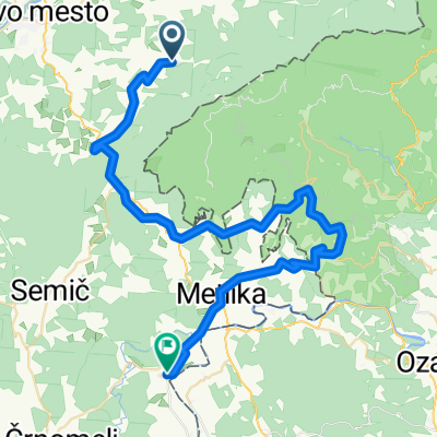
Camino Dolenjska day 2
A cycling route starting in Šentjernej, Občina Šentjernej, Slovenia.
Overview
About this route
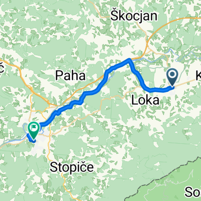
Rakovnik, Šentjernej - Pleterje - Hrušica - NM - Mirna Peč - Hotel Rakar, Trebnje
- -:--
- Duration
- 39.2 km
- Distance
- 455 m
- Ascent
- 532 m
- Descent
- ---
- Avg. speed
- ---
- Max. altitude
Route quality
Waytypes & surfaces along the route
Waytypes
Quiet road
28.6 km
(73 %)
Road
2.7 km
(7 %)
Surfaces
Paved
23.5 km
(60 %)
Unpaved
2.7 km
(7 %)
Asphalt
23.5 km
(60 %)
Gravel
2.4 km
(6 %)
Continue with Bikemap
Use, edit, or download this cycling route
You would like to ride Camino Dolenjska day 2 or customize it for your own trip? Here is what you can do with this Bikemap route:
Free features
- Save this route as favorite or in collections
- Copy & plan your own version of this route
- Sync your route with Garmin or Wahoo
Premium features
Free trial for 3 days, or one-time payment. More about Bikemap Premium.
- Navigate this route on iOS & Android
- Export a GPX / KML file of this route
- Create your custom printout (try it for free)
- Download this route for offline navigation
Discover more Premium features.
Get Bikemap PremiumFrom our community
Other popular routes starting in Šentjernej
Gospodična, Trdinov vrh- Distance
- 21.4 km
- Ascent
- 974 m
- Descent
- 950 m
- Location
- Šentjernej, Občina Šentjernej, Slovenia
Gorjanci- Distance
- 25.7 km
- Ascent
- 991 m
- Descent
- 992 m
- Location
- Šentjernej, Občina Šentjernej, Slovenia
"Dolenjska runda"- Distance
- 38.2 km
- Ascent
- 250 m
- Descent
- 252 m
- Location
- Šentjernej, Občina Šentjernej, Slovenia
Trdinov vrh _Mihovo- Distance
- 33 km
- Ascent
- 1,043 m
- Descent
- 1,042 m
- Location
- Šentjernej, Občina Šentjernej, Slovenia
MTB po Gorjancih- Distance
- 19.1 km
- Ascent
- 707 m
- Descent
- 702 m
- Location
- Šentjernej, Občina Šentjernej, Slovenia
Sv Gera - ozalj -KA-pisarovina -ZG- Distance
- 125.1 km
- Ascent
- 420 m
- Descent
- 1,471 m
- Location
- Šentjernej, Občina Šentjernej, Slovenia
Sevnica- Distance
- 134.8 km
- Ascent
- 462 m
- Descent
- 460 m
- Location
- Šentjernej, Občina Šentjernej, Slovenia
Gorjanci - grebenska- Distance
- 40.3 km
- Ascent
- 1,175 m
- Descent
- 1,170 m
- Location
- Šentjernej, Občina Šentjernej, Slovenia
Open it in the app


