

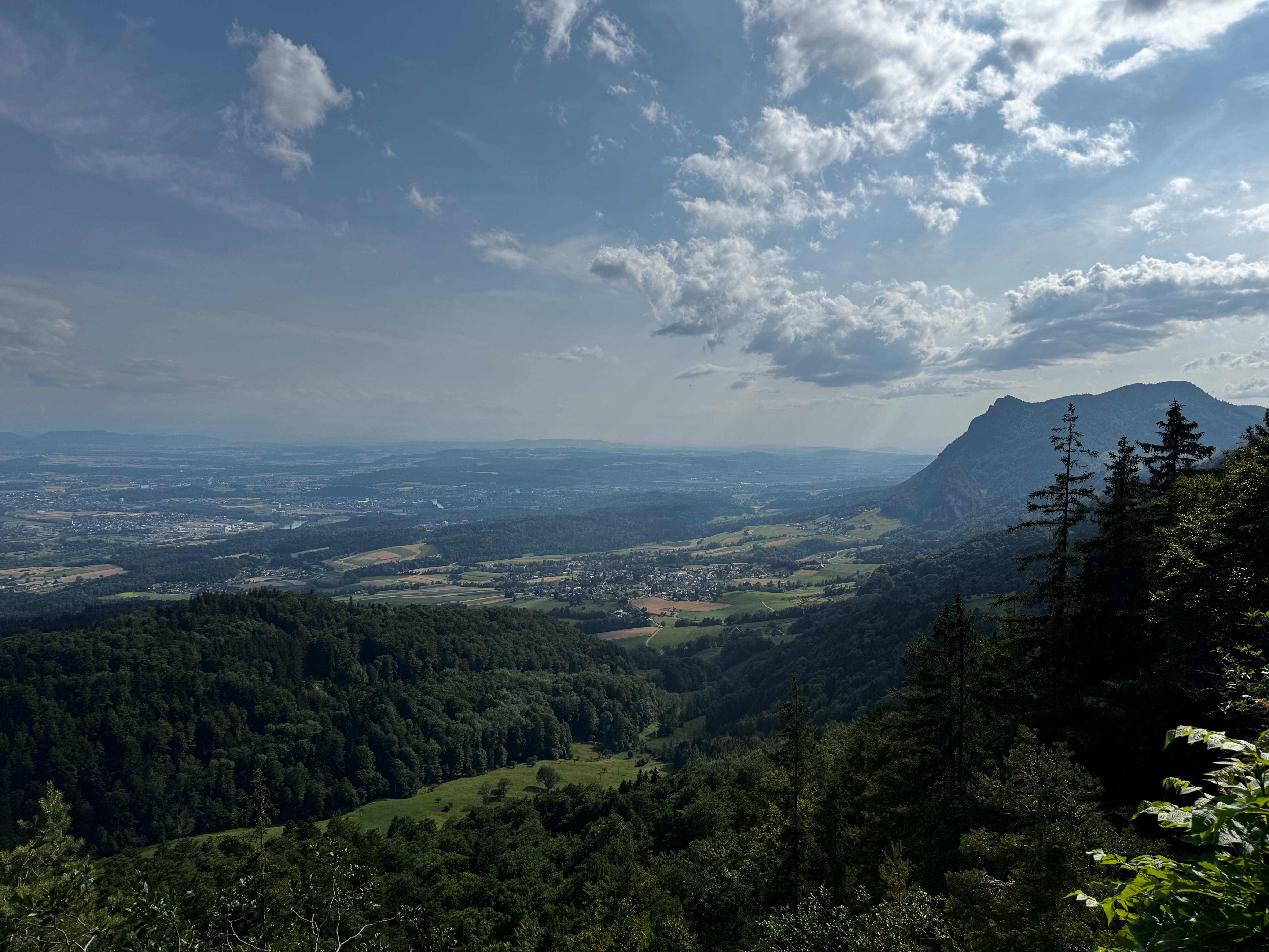
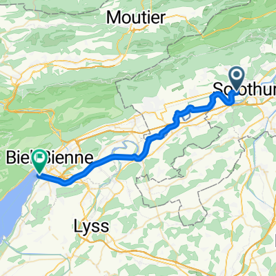
Solothurn-Weissenstein-Grenchen-Solothurn
A cycling route starting in Langendorf, Canton of Solothurn, Switzerland.
Overview
About this route
- -:--
- Duration
- 26.9 km
- Distance
- 1,003 m
- Ascent
- 1,005 m
- Descent
- ---
- Avg. speed
- ---
- Max. altitude

Continue with Bikemap
Use, edit, or download this cycling route
You would like to ride Solothurn-Weissenstein-Grenchen-Solothurn or customize it for your own trip? Here is what you can do with this Bikemap route:
Free features
- Save this route as favorite or in collections
- Copy & plan your own version of this route
- Sync your route with Garmin or Wahoo
Premium features
Free trial for 3 days, or one-time payment. More about Bikemap Premium.
- Navigate this route on iOS & Android
- Export a GPX / KML file of this route
- Create your custom printout (try it for free)
- Download this route for offline navigation
Discover more Premium features.
Get Bikemap PremiumFrom our community
Other popular routes starting in Langendorf
 Solothurn-Gampelen / Asphalt
- Distance
- 48.8 km
- Ascent
- 188 m
- Descent
- 195 m
- Location
- Langendorf, Canton of Solothurn, Switzerland
 Bellach Langenthal Haslibräu
- Distance
- 28.3 km
- Ascent
- 147 m
- Descent
- 118 m
- Location
- Langendorf, Canton of Solothurn, Switzerland
 Weissensteinstrasse 187, Oberdorf nach Weissensteinstrasse 187, Oberdorf
- Distance
- 60.5 km
- Ascent
- 1,195 m
- Descent
- 1,364 m
- Location
- Langendorf, Canton of Solothurn, Switzerland
 Solothurn-Weissenstein-Grenchen-Solothurn
- Distance
- 26.9 km
- Ascent
- 1,003 m
- Descent
- 1,005 m
- Location
- Langendorf, Canton of Solothurn, Switzerland
 Römerstrasse, Bellach nach Römerstrasse, Bellach
- Distance
- 59 km
- Ascent
- 953 m
- Descent
- 951 m
- Location
- Langendorf, Canton of Solothurn, Switzerland
 Bellach / Weissenstein / Balmberg / Solothurn / Bellach
- Distance
- 28.8 km
- Ascent
- 1,087 m
- Descent
- 1,090 m
- Location
- Langendorf, Canton of Solothurn, Switzerland
 solothurn Biel See
- Distance
- 30.3 km
- Ascent
- 24 m
- Descent
- 26 m
- Location
- Langendorf, Canton of Solothurn, Switzerland
 Sonntagsabendtour zur Schauenburg
- Distance
- 24 km
- Ascent
- 846 m
- Descent
- 846 m
- Location
- Langendorf, Canton of Solothurn, Switzerland
Open it in the app