
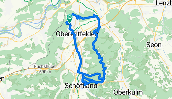
böhler rundi
A cycling route starting in Oberentfelden, Canton of Aargau, Switzerland.
Overview
About this route
- -:--
- Duration
- 33 km
- Distance
- 545 m
- Ascent
- 544 m
- Descent
- ---
- Avg. speed
- ---
- Max. altitude

Route quality
Waytypes & surfaces along the route
Waytypes
Track
12 km
(36 %)
Quiet road
10.5 km
(32 %)
Surfaces
Paved
5.2 km
(16 %)
Unpaved
17.5 km
(53 %)
Gravel
11.3 km
(34 %)
Ground
6.1 km
(18 %)
Continue with Bikemap
Use, edit, or download this cycling route
You would like to ride böhler rundi or customize it for your own trip? Here is what you can do with this Bikemap route:
Free features
- Save this route as favorite or in collections
- Copy & plan your own version of this route
- Sync your route with Garmin or Wahoo
Premium features
Free trial for 3 days, or one-time payment. More about Bikemap Premium.
- Navigate this route on iOS & Android
- Export a GPX / KML file of this route
- Create your custom printout (try it for free)
- Download this route for offline navigation
Discover more Premium features.
Get Bikemap PremiumFrom our community
Other popular routes starting in Oberentfelden
 2 Pässe nördlich Aarau
- Distance
- 42.2 km
- Ascent
- 761 m
- Descent
- 759 m
- Location
- Oberentfelden, Canton of Aargau, Switzerland
 zum böhler and back so gut wie möglich im wald
- Distance
- 33.4 km
- Ascent
- 600 m
- Descent
- 596 m
- Location
- Oberentfelden, Canton of Aargau, Switzerland
 böhler rundi
- Distance
- 33 km
- Ascent
- 545 m
- Descent
- 544 m
- Location
- Oberentfelden, Canton of Aargau, Switzerland
 Suhr nach Arth-Goldau (Tag2)
- Distance
- 73.6 km
- Ascent
- 501 m
- Descent
- 459 m
- Location
- Oberentfelden, Canton of Aargau, Switzerland
 Radrunde vom 31. Mai, 16:41
- Distance
- 19.9 km
- Ascent
- 99 m
- Descent
- 97 m
- Location
- Oberentfelden, Canton of Aargau, Switzerland
 Unterentfelden-Gontenschwil-Unterentfelden
- Distance
- 49.6 km
- Ascent
- 556 m
- Descent
- 560 m
- Location
- Oberentfelden, Canton of Aargau, Switzerland
 Oberentfelden Schöftland Walde Oberentfelden CLONED FROM ROUTE 471592
- Distance
- 36.6 km
- Ascent
- 550 m
- Descent
- 551 m
- Location
- Oberentfelden, Canton of Aargau, Switzerland
 Oberentfelden nach Riehen bzw. Basel CLONED FROM ROUTE 471557
- Distance
- 61.7 km
- Ascent
- 1,006 m
- Descent
- 1,160 m
- Location
- Oberentfelden, Canton of Aargau, Switzerland
Open it in the app