

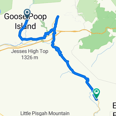
Graybeard Mountain View to Mount Mitchell
A cycling route starting in Black Mountain, North Carolina, United States of America.
Overview
About this route
- -:--
- Duration
- 24 km
- Distance
- 860 m
- Ascent
- 528 m
- Descent
- ---
- Avg. speed
- ---
- Max. altitude

Route quality
Waytypes & surfaces along the route
Waytypes
Busy road
16.8 km
(70 %)
Road
6.9 km
(29 %)
Surfaces
Paved
7.2 km
(30 %)
Asphalt
7.2 km
(30 %)
Undefined
16.8 km
(70 %)
Continue with Bikemap
Use, edit, or download this cycling route
You would like to ride Graybeard Mountain View to Mount Mitchell or customize it for your own trip? Here is what you can do with this Bikemap route:
Free features
- Save this route as favorite or in collections
- Copy & plan your own version of this route
- Sync your route with Garmin or Wahoo
Premium features
Free trial for 3 days, or one-time payment. More about Bikemap Premium.
- Navigate this route on iOS & Android
- Export a GPX / KML file of this route
- Create your custom printout (try it for free)
- Download this route for offline navigation
Discover more Premium features.
Get Bikemap PremiumFrom our community
Other popular routes starting in Black Mountain
 Black Mountain Loop
- Distance
- 13.3 km
- Ascent
- 184 m
- Descent
- 199 m
- Location
- Black Mountain, North Carolina, United States of America
 Hebron Road Climb
- Distance
- 6.3 km
- Ascent
- 254 m
- Descent
- 45 m
- Location
- Black Mountain, North Carolina, United States of America
 9 Winding Poplar Rd, Black Mountain to 9 Winding Poplar Rd, Black Mountain
- Distance
- 7.5 km
- Ascent
- 360 m
- Descent
- 362 m
- Location
- Black Mountain, North Carolina, United States of America
 Black Mountain to Midmorning Asheville Bus
- Distance
- 16.7 km
- Ascent
- 199 m
- Descent
- 352 m
- Location
- Black Mountain, North Carolina, United States of America
 montreat highway 9
- Distance
- 28.5 km
- Ascent
- 387 m
- Descent
- 364 m
- Location
- Black Mountain, North Carolina, United States of America
 BM to CCC
- Distance
- 36.4 km
- Ascent
- 755 m
- Descent
- 923 m
- Location
- Black Mountain, North Carolina, United States of America
 Mount Mitchell Loop
- Distance
- 146.3 km
- Ascent
- 2,124 m
- Descent
- 2,119 m
- Location
- Black Mountain, North Carolina, United States of America
 Graybeard Mountain View to Mount Mitchell
- Distance
- 24 km
- Ascent
- 860 m
- Descent
- 528 m
- Location
- Black Mountain, North Carolina, United States of America
Open it in the app