Kappelrodeck-Hornisgrinde
A cycling route starting in Kappelrodeck, Baden-Württemberg, Germany.
Overview
About this route
- -:--
- Duration
- 15.9 km
- Distance
- 1,020 m
- Ascent
- 74 m
- Descent
- ---
- Avg. speed
- ---
- Max. altitude
Route quality
Waytypes & surfaces along the route
Waytypes
Track
8.9 km
(56 %)
Quiet road
1.7 km
(11 %)
Surfaces
Paved
6.1 km
(38 %)
Unpaved
9.2 km
(58 %)
Gravel
8.1 km
(51 %)
Asphalt
6.1 km
(38 %)
Continue with Bikemap
Use, edit, or download this cycling route
You would like to ride Kappelrodeck-Hornisgrinde or customize it for your own trip? Here is what you can do with this Bikemap route:
Free features
- Save this route as favorite or in collections
- Copy & plan your own version of this route
- Sync your route with Garmin or Wahoo
Premium features
Free trial for 3 days, or one-time payment. More about Bikemap Premium.
- Navigate this route on iOS & Android
- Export a GPX / KML file of this route
- Create your custom printout (try it for free)
- Download this route for offline navigation
Discover more Premium features.
Get Bikemap PremiumFrom our community
Other popular routes starting in Kappelrodeck
- tour 170717 um ulm herum und trailcenter sasbachwalden
- Distance
- 42.3 km
- Ascent
- 993 m
- Descent
- 993 m
- Location
- Kappelrodeck, Baden-Württemberg, Germany
- 33333
- Distance
- 4.4 km
- Ascent
- 85 m
- Descent
- 86 m
- Location
- Kappelrodeck, Baden-Württemberg, Germany
- Kappelrodeck-Hornisgrinde
- Distance
- 15.9 km
- Ascent
- 1,020 m
- Descent
- 74 m
- Location
- Kappelrodeck, Baden-Württemberg, Germany
- kurze Mummelsee Rundfahrt
- Distance
- 37.8 km
- Ascent
- 1,055 m
- Descent
- 1,057 m
- Location
- Kappelrodeck, Baden-Württemberg, Germany
- Christian 4.8.20
- Distance
- 14.3 km
- Ascent
- 507 m
- Descent
- 501 m
- Location
- Kappelrodeck, Baden-Württemberg, Germany
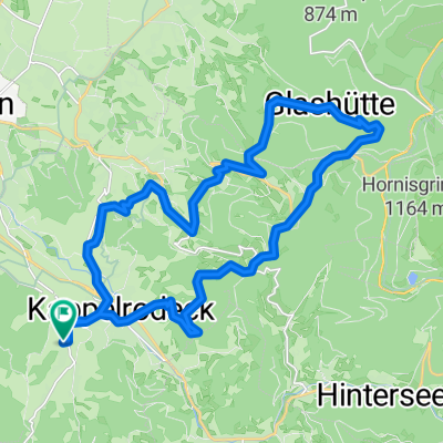
- Oppenau-Allerh.-Ottenh.-Seebach-Schönbüch
- Distance
- 59.3 km
- Ascent
- 990 m
- Descent
- 990 m
- Location
- Kappelrodeck, Baden-Württemberg, Germany
- Rundfahrt Glashütte, Unterstmatt
- Distance
- 42.7 km
- Ascent
- 1,172 m
- Descent
- 1,174 m
- Location
- Kappelrodeck, Baden-Württemberg, Germany
- 333333333333
- Distance
- 10.1 km
- Ascent
- 939 m
- Descent
- 255 m
- Location
- Kappelrodeck, Baden-Württemberg, Germany
Open it in the app