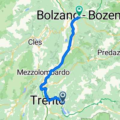
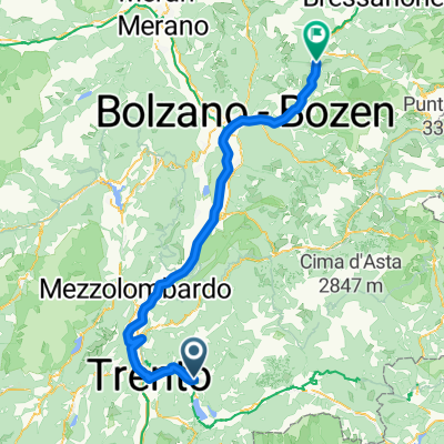
giro dei piani di susa e bosentino.
A cycling route starting in Pergine Valsugana, Trentino-Alto Adige, Italy.
Overview
About this route
- 2 h 1 min
- Duration
- 13.6 km
- Distance
- 1,195 m
- Ascent
- 660 m
- Descent
- 6.8 km/h
- Avg. speed
- ---
- Avg. speed
Route quality
Waytypes & surfaces along the route
Waytypes
Track
7.9 km
(58 %)
Quiet road
4.9 km
(36 %)
Surfaces
Paved
4.7 km
(35 %)
Unpaved
4.5 km
(33 %)
Gravel
3.6 km
(26 %)
Paved (undefined)
3 km
(22 %)
Continue with Bikemap
Use, edit, or download this cycling route
You would like to ride giro dei piani di susa e bosentino. or customize it for your own trip? Here is what you can do with this Bikemap route:
Free features
- Save this route as favorite or in collections
- Copy & plan your own version of this route
- Sync your route with Garmin or Wahoo
Premium features
Free trial for 3 days, or one-time payment. More about Bikemap Premium.
- Navigate this route on iOS & Android
- Export a GPX / KML file of this route
- Create your custom printout (try it for free)
- Download this route for offline navigation
Discover more Premium features.
Get Bikemap PremiumFrom our community
Other popular routes starting in Pergine Valsugana
- Pergine - Bassano
- Distance
- 79 km
- Ascent
- 253 m
- Descent
- 587 m
- Location
- Pergine Valsugana, Trentino-Alto Adige, Italy
- Giro dei laghi breve
- Distance
- 24.8 km
- Ascent
- 260 m
- Descent
- 260 m
- Location
- Pergine Valsugana, Trentino-Alto Adige, Italy
- VS_ Pergine - Bassano del Grappa
- Distance
- 85.4 km
- Ascent
- 193 m
- Descent
- 552 m
- Location
- Pergine Valsugana, Trentino-Alto Adige, Italy
- giro dei piani di susa e bosentino.
- Distance
- 13.6 km
- Ascent
- 1,195 m
- Descent
- 660 m
- Location
- Pergine Valsugana, Trentino-Alto Adige, Italy
- 20191005 Valsugana da S.Cristoforo a Novaledo
- Distance
- 16.2 km
- Ascent
- 59 m
- Descent
- 90 m
- Location
- Pergine Valsugana, Trentino-Alto Adige, Italy
- giro dei laghi 2
- Distance
- 23.4 km
- Ascent
- 520 m
- Descent
- 515 m
- Location
- Pergine Valsugana, Trentino-Alto Adige, Italy
- Giro del castello e lago (via Tenna)
- Distance
- 25.4 km
- Ascent
- 255 m
- Descent
- 253 m
- Location
- Pergine Valsugana, Trentino-Alto Adige, Italy
- CALDONAZZO-MANGHEN-BEDOLLO
- Distance
- 108.8 km
- Ascent
- 2,025 m
- Descent
- 2,023 m
- Location
- Pergine Valsugana, Trentino-Alto Adige, Italy
Open it in the app