

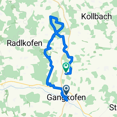
mtb runde obertrennbach-Reicheneibach-Rattenbach-Kollbach
A cycling route starting in Gangkofen, Bavaria, Germany.
Overview
About this route
- 1 h 32 min
- Duration
- 28 km
- Distance
- 428 m
- Ascent
- 445 m
- Descent
- 18.3 km/h
- Avg. speed
- ---
- Max. altitude
Route quality
Waytypes & surfaces along the route
Waytypes
Track
15.9 km
(57 %)
Quiet road
6.2 km
(22 %)
Surfaces
Paved
10.4 km
(37 %)
Unpaved
15.4 km
(55 %)
Gravel
9.8 km
(35 %)
Asphalt
9.2 km
(33 %)
Continue with Bikemap
Use, edit, or download this cycling route
You would like to ride mtb runde obertrennbach-Reicheneibach-Rattenbach-Kollbach or customize it for your own trip? Here is what you can do with this Bikemap route:
Free features
- Save this route as favorite or in collections
- Copy & plan your own version of this route
- Sync your route with Garmin or Wahoo
Premium features
Free trial for 3 days, or one-time payment. More about Bikemap Premium.
- Navigate this route on iOS & Android
- Export a GPX / KML file of this route
- Create your custom printout (try it for free)
- Download this route for offline navigation
Discover more Premium features.
Get Bikemap PremiumFrom our community
Other popular routes starting in Gangkofen
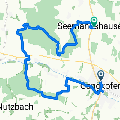
 Am Anger, Gangkofen nach Seemannshausen, Gangkofen
- Distance
- 31.9 km
- Ascent
- 341 m
- Descent
- 304 m
- Location
- Gangkofen, Bavaria, Germany
 Gangkofen, Postmünster, Pfarrkirchen
- Distance
- 71.8 km
- Ascent
- 238 m
- Descent
- 289 m
- Location
- Gangkofen, Bavaria, Germany
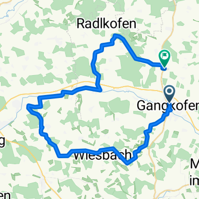
 Am Anger, Gangkofen nach Am Anger, Gangkofen
- Distance
- 17.7 km
- Ascent
- 208 m
- Descent
- 208 m
- Location
- Gangkofen, Bavaria, Germany
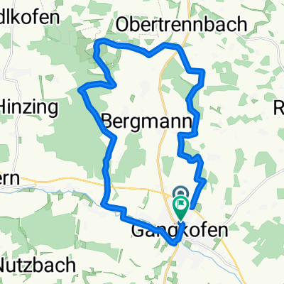
 Kapellentour um Obertrennbach
- Distance
- 39.1 km
- Ascent
- 9,492 m
- Descent
- 9,469 m
- Location
- Gangkofen, Bavaria, Germany
 Am Anger, Gangkofen nach Seemannshausen, Gangkofen
- Distance
- 15.2 km
- Ascent
- 231 m
- Descent
- 190 m
- Location
- Gangkofen, Bavaria, Germany
 Buschtour, quer durch den Wald
- Distance
- 27.2 km
- Ascent
- 340 m
- Descent
- 396 m
- Location
- Gangkofen, Bavaria, Germany
 Am Anger, Gangkofen nach Am Anger, Gangkofen
- Distance
- 17.7 km
- Ascent
- 176 m
- Descent
- 180 m
- Location
- Gangkofen, Bavaria, Germany
 Am Anger, Gangkofen nach Seemannshausen, Gangkofen
- Distance
- 22.3 km
- Ascent
- 355 m
- Descent
- 314 m
- Location
- Gangkofen, Bavaria, Germany
Open it in the app