

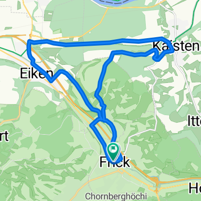
Fricktaler Huegelvergnuege Abendtraining
A cycling route starting in Frick, Canton of Aargau, Switzerland.
Overview
About this route
who races down after a long climb from Buschberg to Rothenflue (Caution curve!) recovers briefly and enjoys twice more the wonderful change between ascent and descent. An experience and a good evening workout in appealing scenery - rather quiet roads.
- -:--
- Duration
- 27.8 km
- Distance
- 406 m
- Ascent
- 345 m
- Descent
- ---
- Avg. speed
- 651 m
- Max. altitude
Route quality
Waytypes & surfaces along the route
Waytypes
Quiet road
9.4 km
(34 %)
Road
5.8 km
(21 %)
Surfaces
Paved
25.3 km
(91 %)
Unpaved
0.3 km
(1 %)
Asphalt
23.3 km
(84 %)
Paved (undefined)
1.9 km
(7 %)
Continue with Bikemap
Use, edit, or download this cycling route
You would like to ride Fricktaler Huegelvergnuege Abendtraining or customize it for your own trip? Here is what you can do with this Bikemap route:
Free features
- Save this route as favorite or in collections
- Copy & plan your own version of this route
- Sync your route with Garmin or Wahoo
Premium features
Free trial for 3 days, or one-time payment. More about Bikemap Premium.
- Navigate this route on iOS & Android
- Export a GPX / KML file of this route
- Create your custom printout (try it for free)
- Download this route for offline navigation
Discover more Premium features.
Get Bikemap PremiumFrom our community
Other popular routes starting in Frick
 Fricktaler Huegelvergnuege Abendtraining
- Distance
- 27.8 km
- Ascent
- 406 m
- Descent
- 345 m
- Location
- Frick, Canton of Aargau, Switzerland
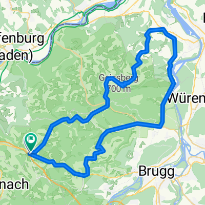
 Recovered Route
- Distance
- 52.3 km
- Ascent
- 396 m
- Descent
- 462 m
- Location
- Frick, Canton of Aargau, Switzerland
 Frick Kaisten Eiken
- Distance
- 16.2 km
- Ascent
- 208 m
- Descent
- 206 m
- Location
- Frick, Canton of Aargau, Switzerland
 MTB Hornussen 2013 60 km
- Distance
- 56.9 km
- Ascent
- 1,372 m
- Descent
- 1,372 m
- Location
- Frick, Canton of Aargau, Switzerland
 Bözen-Bözberg-Leuggern-Hottwil-Mönthal-Bözen
- Distance
- 43.3 km
- Ascent
- 634 m
- Descent
- 621 m
- Location
- Frick, Canton of Aargau, Switzerland
 1. Etappe Frick - Lenzkirch
- Distance
- 87.4 km
- Ascent
- 1,244 m
- Descent
- 747 m
- Location
- Frick, Canton of Aargau, Switzerland
 A-Frick-Magden-Frick
- Distance
- 71.7 km
- Ascent
- 1,064 m
- Descent
- 1,067 m
- Location
- Frick, Canton of Aargau, Switzerland
 Hauptstrasse, Bözen nach Kirchweg, Bözen
- Distance
- 13.1 km
- Ascent
- 92 m
- Descent
- 80 m
- Location
- Frick, Canton of Aargau, Switzerland
Open it in the app