

Die - Col du Rousset - La Chapelle-en-Vercors 85km-1600m
A cycling route starting in Die, Auvergne-Rhône-Alpes, France.
Overview
About this route
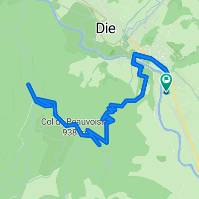
The Col du Rousset is a very scenic pass and the only access from the south into the Vercors. From Die, the pass never really climbs above 6-7% and is very good and consistent to ride. There are always great views, especially from the parking lot at the summit tunnel (bring a light). Unfortunately, the Col is a popular route for hordes of motorcycles and sports cars - this detracts from the true enjoyment of the climb and the fantastic descent. So, it’s best to start early in the morning or late in the afternoon.
After the summit tunnel, the loop in the Vercors is very beautiful and has little traffic - a small homage to the Resistance in the Vercors with the beautiful (reconstructed) town of La Chapelle-en-Vercors at the turning point of the loop. (My Garmin Fenix 5 measured 'only' 1600 meters of elevation gain)
- -:--
- Duration
- 84.3 km
- Distance
- 1,513 m
- Ascent
- 1,513 m
- Descent
- ---
- Avg. speed
- ---
- Max. altitude

Continue with Bikemap
Use, edit, or download this cycling route
You would like to ride Die - Col du Rousset - La Chapelle-en-Vercors 85km-1600m or customize it for your own trip? Here is what you can do with this Bikemap route:
Free features
- Save this route as favorite or in collections
- Copy & plan your own version of this route
- Split it into stages to create a multi-day tour
- Sync your route with Garmin or Wahoo
Premium features
Free trial for 3 days, or one-time payment. More about Bikemap Premium.
- Navigate this route on iOS & Android
- Export a GPX / KML file of this route
- Create your custom printout (try it for free)
- Download this route for offline navigation
Discover more Premium features.
Get Bikemap PremiumFrom our community
Other popular routes starting in Die
 Die - Die über Croix de Justin
- Distance
- 17.4 km
- Ascent
- 605 m
- Descent
- 604 m
- Location
- Die, Auvergne-Rhône-Alpes, France
 QuälDich Route 1 150km !!
- Distance
- 74.5 km
- Ascent
- 2,894 m
- Descent
- 3,082 m
- Location
- Die, Auvergne-Rhône-Alpes, France
 Die - Col du Rousset - La Chapelle-en-Vercors 85km-1600m
- Distance
- 84.3 km
- Ascent
- 1,513 m
- Descent
- 1,513 m
- Location
- Die, Auvergne-Rhône-Alpes, France
 2016 Ride Day 89 - Jansac to Valence
- Distance
- 90.1 km
- Ascent
- 177 m
- Descent
- 702 m
- Location
- Die, Auvergne-Rhône-Alpes, France
 Alpentocht 2015 dag 2 Definitief
- Distance
- 97 km
- Ascent
- 2,122 m
- Descent
- 1,224 m
- Location
- Die, Auvergne-Rhône-Alpes, France
 quäldich Route 2 150km
- Distance
- 73 km
- Ascent
- 2,880 m
- Descent
- 3,068 m
- Location
- Die, Auvergne-Rhône-Alpes, France
 Route nach Avenue de la Clairette 90, Die
- Distance
- 40.4 km
- Ascent
- 1,166 m
- Descent
- 1,165 m
- Location
- Die, Auvergne-Rhône-Alpes, France
 Vercheny - Col de Penne - Die
- Distance
- 48.9 km
- Ascent
- 946 m
- Descent
- 746 m
- Location
- Die, Auvergne-Rhône-Alpes, France
Open it in the app