

Irfersgrün_Hanna_Pöhl
A cycling route starting in Waldkirchen, Saxony, Germany.
Overview
About this route
- -:--
- Duration
- 26.9 km
- Distance
- 322 m
- Ascent
- 338 m
- Descent
- ---
- Avg. speed
- ---
- Max. altitude
Route quality
Waytypes & surfaces along the route
Waytypes
Road
15 km
(56 %)
Quiet road
0.8 km
(3 %)
Surfaces
Paved
11.8 km
(44 %)
Asphalt
11.8 km
(44 %)
Undefined
15 km
(56 %)
Route highlights
Points of interest along the route
Point of interest after 21.7 km
Tante Hanna
Continue with Bikemap
Use, edit, or download this cycling route
You would like to ride Irfersgrün_Hanna_Pöhl or customize it for your own trip? Here is what you can do with this Bikemap route:
Free features
- Save this route as favorite or in collections
- Copy & plan your own version of this route
- Sync your route with Garmin or Wahoo
Premium features
Free trial for 3 days, or one-time payment. More about Bikemap Premium.
- Navigate this route on iOS & Android
- Export a GPX / KML file of this route
- Create your custom printout (try it for free)
- Download this route for offline navigation
Discover more Premium features.
Get Bikemap PremiumFrom our community
Other popular routes starting in Waldkirchen
 Mühlteichrunde
- Distance
- 30.7 km
- Ascent
- 330 m
- Descent
- 298 m
- Location
- Waldkirchen, Saxony, Germany
 plohnis Neuigkeiten
- Distance
- 20.7 km
- Ascent
- 368 m
- Descent
- 346 m
- Location
- Waldkirchen, Saxony, Germany
 Rund um Stangengrün
- Distance
- 7.3 km
- Ascent
- 98 m
- Descent
- 97 m
- Location
- Waldkirchen, Saxony, Germany
 Zielanfahrt
- Distance
- 1.6 km
- Ascent
- 50 m
- Descent
- 0 m
- Location
- Waldkirchen, Saxony, Germany
 Reichenbacher Straße 224, Heinsdorfergrund nach Untere Kirchstraße 6, Oelsnitz/Vogtl.
- Distance
- 34.9 km
- Ascent
- 462 m
- Descent
- 474 m
- Location
- Waldkirchen, Saxony, Germany
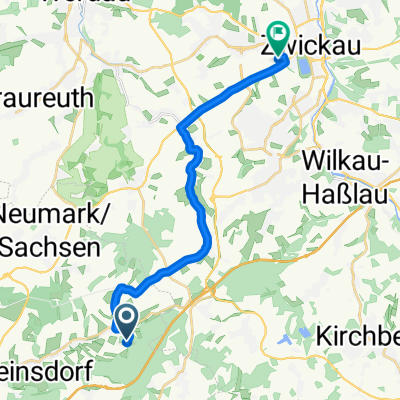 Zwickau
- Distance
- 16.4 km
- Ascent
- 98 m
- Descent
- 238 m
- Location
- Waldkirchen, Saxony, Germany
 Hauptmannsgrün-Mylau
- Distance
- 29.2 km
- Ascent
- 267 m
- Descent
- 267 m
- Location
- Waldkirchen, Saxony, Germany
 Umleitung
- Distance
- 4.1 km
- Ascent
- 29 m
- Descent
- 85 m
- Location
- Waldkirchen, Saxony, Germany
Open it in the app