

Waldroute zum Rhein-Weser-Turm
A cycling route starting in Erndtebrück, North Rhine-Westphalia, Germany.
Overview
About this route
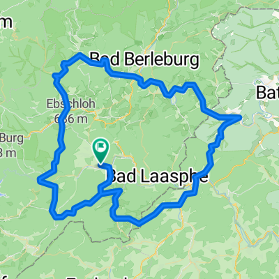
Über Amtshausen und Schameder nach Zinse, östlich vorbei am Dreiherrenstein zum Rüsper Berg, über den Milsenberg zum Panoramapark und dem Rhein-Weser-Turm, Richtung Nordosten zum Grummes Köpfchen (Höchster Punkt der Route), dann Richtung Osten auf die Landstraße zur Wisent-Wildnis, über Aue, Balde ud Holzhausen zurück nach Feudingen
- -:--
- Duration
- 57.9 km
- Distance
- 726 m
- Ascent
- 729 m
- Descent
- ---
- Avg. speed
- ---
- Max. altitude

Route quality
Waytypes & surfaces along the route
Waytypes
Road
17.2 km
(30 %)
Busy road
15.2 km
(26 %)
Surfaces
Paved
27.5 km
(48 %)
Unpaved
9.8 km
(17 %)
Asphalt
27.5 km
(48 %)
Gravel
4.9 km
(8 %)
Continue with Bikemap
Use, edit, or download this cycling route
You would like to ride Waldroute zum Rhein-Weser-Turm or customize it for your own trip? Here is what you can do with this Bikemap route:
Free features
- Save this route as favorite or in collections
- Copy & plan your own version of this route
- Sync your route with Garmin or Wahoo
Premium features
Free trial for 3 days, or one-time payment. More about Bikemap Premium.
- Navigate this route on iOS & Android
- Export a GPX / KML file of this route
- Create your custom printout (try it for free)
- Download this route for offline navigation
Discover more Premium features.
Get Bikemap PremiumFrom our community
Other popular routes starting in Erndtebrück
 lahntal feudingen-koblenz
- Distance
- 250.8 km
- Ascent
- 2,199 m
- Descent
- 2,514 m
- Location
- Erndtebrück, North Rhine-Westphalia, Germany
 Lahn 2014
- Distance
- 217.3 km
- Ascent
- 2,614 m
- Descent
- 3,025 m
- Location
- Erndtebrück, North Rhine-Westphalia, Germany
 Ilsetal-Fischelbach-Dietzhölztal-Hainchen-Deutz-Siegquelle-Benfe-Leimstruth
- Distance
- 76.7 km
- Ascent
- 851 m
- Descent
- 855 m
- Location
- Erndtebrück, North Rhine-Westphalia, Germany
 5 Bäche-Tour: Eder, Lahn, Perf, Banfe + Ilse
- Distance
- 104.4 km
- Ascent
- 909 m
- Descent
- 912 m
- Location
- Erndtebrück, North Rhine-Westphalia, Germany
 Ilsetal-Edertal-R8-Perftalsee-Banfetal
- Distance
- 100.9 km
- Ascent
- 751 m
- Descent
- 750 m
- Location
- Erndtebrück, North Rhine-Westphalia, Germany
 erndtebrück zinse röspe erndtebrück
- Distance
- 11.3 km
- Ascent
- 135 m
- Descent
- 194 m
- Location
- Erndtebrück, North Rhine-Westphalia, Germany
 Lahntal-Radweg
- Distance
- 245.8 km
- Ascent
- 235 m
- Descent
- 781 m
- Location
- Erndtebrück, North Rhine-Westphalia, Germany
 2. Lahnquelle - Marburg
- Distance
- 67.3 km
- Ascent
- 539 m
- Descent
- 945 m
- Location
- Erndtebrück, North Rhine-Westphalia, Germany
Open it in the app