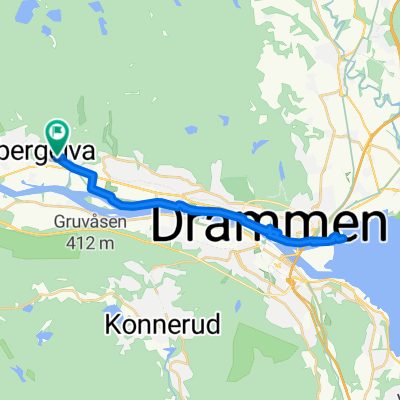
Norwegia - projekt
A cycling route starting in Mjøndalen, Buskerud, Norway.
Overview
About this route
test
- -:--
- Duration
- 30.9 km
- Distance
- 916 m
- Ascent
- 870 m
- Descent
- ---
- Avg. speed
- ---
- Max. altitude
Route quality
Waytypes & surfaces along the route
Waytypes
Path
22.7 km
(74 %)
Track
6.5 km
(21 %)
Surfaces
Paved
0.7 km
(2 %)
Unpaved
5.8 km
(19 %)
Ground
3 km
(10 %)
Gravel
1.4 km
(5 %)
Route highlights
Points of interest along the route
Point of interest after 0.6 km
wąwóz
Point of interest after 9.9 km
Urwisko
Accommodation after 13.2 km
Jeziorko
Point of interest after 17.6 km
"Zejście Indiany Jonesa" :-)
Accommodation after 23.2 km
Gdzieś tu drugi nocleg
Continue with Bikemap
Use, edit, or download this cycling route
You would like to ride Norwegia - projekt or customize it for your own trip? Here is what you can do with this Bikemap route:
Free features
- Save this route as favorite or in collections
- Copy & plan your own version of this route
- Sync your route with Garmin or Wahoo
Premium features
Free trial for 3 days, or one-time payment. More about Bikemap Premium.
- Navigate this route on iOS & Android
- Export a GPX / KML file of this route
- Create your custom printout (try it for free)
- Download this route for offline navigation
Discover more Premium features.
Get Bikemap PremiumFrom our community
Other popular routes starting in Mjøndalen
- Solberg terrasse 10, Solbergmoen to Beitostølen
- Distance
- 340 km
- Ascent
- 5,950 m
- Descent
- 5,131 m
- Location
- Mjøndalen, Buskerud, Norway
- Runde 83 - Bakketempo - Langrand
- Distance
- 2 km
- Ascent
- 149 m
- Descent
- 9 m
- Location
- Mjøndalen, Buskerud, Norway
- vestfossen-eidsfoss-sande-drammen
- Distance
- 79.9 km
- Ascent
- 746 m
- Descent
- 748 m
- Location
- Mjøndalen, Buskerud, Norway
- Test 1
- Distance
- 12.8 km
- Ascent
- 528 m
- Descent
- 171 m
- Location
- Mjøndalen, Buskerud, Norway
- Norwegia - projekt
- Distance
- 30.9 km
- Ascent
- 916 m
- Descent
- 870 m
- Location
- Mjøndalen, Buskerud, Norway
- Recovered Route
- Distance
- 11.7 km
- Ascent
- 226 m
- Descent
- 244 m
- Location
- Mjøndalen, Buskerud, Norway
- Stubberudveien 164B, Drammen to Kollerudveien 16, Drammen
- Distance
- 22.8 km
- Ascent
- 427 m
- Descent
- 532 m
- Location
- Mjøndalen, Buskerud, Norway
- Krokstadelva-Drammen Krokstadelva
- Distance
- 39.4 km
- Ascent
- 231 m
- Descent
- 230 m
- Location
- Mjøndalen, Buskerud, Norway
Open it in the app