

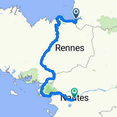
2: Mont St Michel to Saintes
A cycling route starting in Roz-sur-Couesnon, Brittany Region, France.
Overview
About this route
500km down to Saintes, where the route should join the main Paris route to the Camino.
- -:--
- Duration
- 384 km
- Distance
- 617 m
- Ascent
- 622 m
- Descent
- ---
- Avg. speed
- ---
- Max. altitude
Route quality
Waytypes & surfaces along the route
Waytypes
Road
195.8 km
(51 %)
Quiet road
76.8 km
(20 %)
Surfaces
Paved
92.1 km
(24 %)
Unpaved
7.7 km
(2 %)
Asphalt
88.3 km
(23 %)
Gravel
7.7 km
(2 %)
Continue with Bikemap
Use, edit, or download this cycling route
You would like to ride 2: Mont St Michel to Saintes or customize it for your own trip? Here is what you can do with this Bikemap route:
Free features
- Save this route as favorite or in collections
- Copy & plan your own version of this route
- Split it into stages to create a multi-day tour
- Sync your route with Garmin or Wahoo
Premium features
Free trial for 3 days, or one-time payment. More about Bikemap Premium.
- Navigate this route on iOS & Android
- Export a GPX / KML file of this route
- Create your custom printout (try it for free)
- Download this route for offline navigation
Discover more Premium features.
Get Bikemap PremiumFrom our community
Other popular routes starting in Roz-sur-Couesnon
 Mont Saint Michel-Nantes
- Distance
- 416.8 km
- Ascent
- 2,271 m
- Descent
- 2,263 m
- Location
- Roz-sur-Couesnon, Brittany Region, France
 bretagna2°stage (ipotesi)
- Distance
- 243.7 km
- Ascent
- 695 m
- Descent
- 649 m
- Location
- Roz-sur-Couesnon, Brittany Region, France
 Mont Saint Michel - Roscff
- Distance
- 348.7 km
- Ascent
- 822 m
- Descent
- 814 m
- Location
- Roz-sur-Couesnon, Brittany Region, France
 Le Mont Saint Michel nach Saint-Malo
- Distance
- 47.7 km
- Ascent
- 95 m
- Descent
- 137 m
- Location
- Roz-sur-Couesnon, Brittany Region, France
 pleboulle
- Distance
- 85.5 km
- Ascent
- 457 m
- Descent
- 432 m
- Location
- Roz-sur-Couesnon, Brittany Region, France
 Grande Rue, Le Mont-Saint-Michel à L'Hôpital, Roz-sur-Couesnon
- Distance
- 13.4 km
- Ascent
- 59 m
- Descent
- 38 m
- Location
- Roz-sur-Couesnon, Brittany Region, France
 De Grande Rue 10, Le Mont-Saint-Michel à Grande Rue 10, Le Mont-Saint-Michel
- Distance
- 51.8 km
- Ascent
- 435 m
- Descent
- 433 m
- Location
- Roz-sur-Couesnon, Brittany Region, France
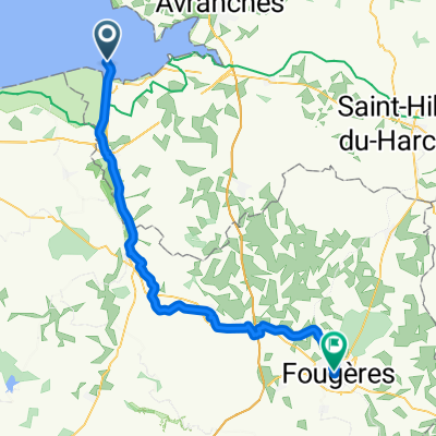 Von Le Mont-Saint-Michel bis Fougères
- Distance
- 54.6 km
- Ascent
- 342 m
- Descent
- 217 m
- Location
- Roz-sur-Couesnon, Brittany Region, France
Open it in the app