

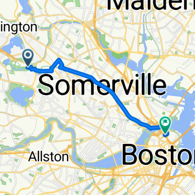
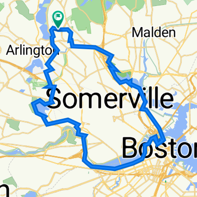
Winchester Highlands
A cycling route starting in Arlington, Massachusetts, United States.
Overview
About this route
- -:--
- Duration
- 26.2 km
- Distance
- 236 m
- Ascent
- 239 m
- Descent
- ---
- Avg. speed
- ---
- Max. altitude

Route quality
Waytypes & surfaces along the route
Waytypes
Road
10.2 km
(39 %)
Quiet road
5 km
(19 %)
Surfaces
Paved
16.5 km
(63 %)
Asphalt
16.5 km
(63 %)
Undefined
9.7 km
(37 %)
Continue with Bikemap
Use, edit, or download this cycling route
You would like to ride Winchester Highlands or customize it for your own trip? Here is what you can do with this Bikemap route:
Free features
- Save this route as favorite or in collections
- Copy & plan your own version of this route
- Sync your route with Garmin or Wahoo
Premium features
Free trial for 3 days, or one-time payment. More about Bikemap Premium.
- Navigate this route on iOS & Android
- Export a GPX / KML file of this route
- Create your custom printout (try it for free)
- Download this route for offline navigation
Discover more Premium features.
Get Bikemap PremiumFrom our community
Other popular routes starting in Arlington
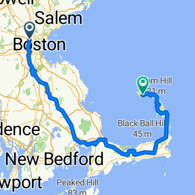
 Lynn Beach
- Distance
- 33.7 km
- Ascent
- 163 m
- Descent
- 214 m
- Location
- Arlington, Massachusetts, United States
 Mystic Valley Pkwy, Medford to Swanton St, Winchester
- Distance
- 5.3 km
- Ascent
- 31 m
- Descent
- 22 m
- Location
- Arlington, Massachusetts, United States
 Mystic Valley Pkwy, Medford to Olive St, Winchester
- Distance
- 5.6 km
- Ascent
- 34 m
- Descent
- 28 m
- Location
- Arlington, Massachusetts, United States
 Acorn Park Dr, Cambridge to West End, Boston
- Distance
- 10.1 km
- Ascent
- 56 m
- Descent
- 56 m
- Location
- Arlington, Massachusetts, United States
 Charlestown/Boston/Cambridge circle
- Distance
- 37.8 km
- Ascent
- 164 m
- Descent
- 166 m
- Location
- Arlington, Massachusetts, United States
 Strawberry Hill Curve street Loop CLONED FROM ROUTE 183722
- Distance
- 57.5 km
- Ascent
- 315 m
- Descent
- 305 m
- Location
- Arlington, Massachusetts, United States
 Beat the Ferry Oct 4th 2025
- Distance
- 256.1 km
- Ascent
- 1,731 m
- Descent
- 1,730 m
- Location
- Arlington, Massachusetts, United States
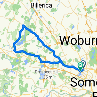 Arlington - Carlyle Loop
- Distance
- 46.8 km
- Ascent
- 201 m
- Descent
- 192 m
- Location
- Arlington, Massachusetts, United States
Open it in the app