TheBiker_lockereAusfahrt
- 28.2 km
- 559 m
- 536 m
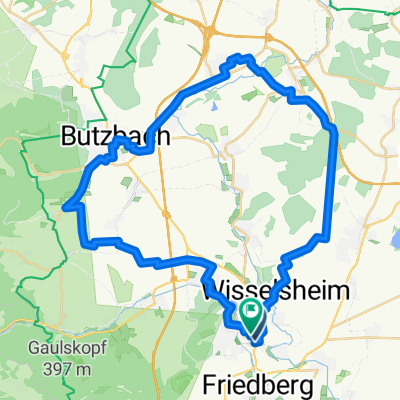
- Bad Nauheim, Hesse, Germany
A cycling route starting in Bad Nauheim, Hesse, Germany.
Overview
Easy route on bike paths with beautiful panoramic views in the Wetterau.
Tour and MTB
created this 15 years ago
Route quality
Track
17.2 km
(57 %)
Quiet road
4.2 km
(14 %)
Paved
22.7 km
(75 %)
Unpaved
3.9 km
(13 %)
Asphalt
11.5 km
(38 %)
Paved (undefined)
7.6 km
(25 %)
Route highlights


Continue with Bikemap
You would like to ride Radtour von Bad Nauheim nach Butzbach, Richtung Hoch-Weisel u. zurück or customize it for your own trip? Here is what you can do with this Bikemap route:
Free trial for 3 days, or one-time payment. More about Bikemap Premium.
Discover more Premium features.
Get Bikemap PremiumFrom our community
Open it in the app