

Jour 4b
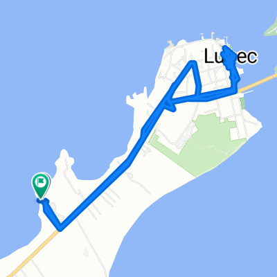
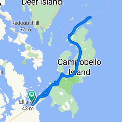
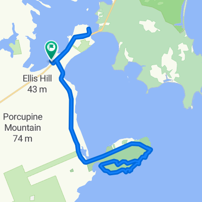
A cycling route starting in Eastport, State of Maine, United States.
Overview
About this route
Change itinerary
- -:--
- Duration
- 117.4 km
- Distance
- 367 m
- Ascent
- 349 m
- Descent
- ---
- Avg. speed
- ---
- Max. altitude
Route quality
Waytypes & surfaces along the route
Waytypes
Access road
15.3 km
(13 %)
Quiet road
12.9 km
(11 %)
Surfaces
Paved
32.9 km
(28 %)
Unpaved
15.3 km
(13 %)
Paved (undefined)
29.3 km
(25 %)
Gravel
14.1 km
(12 %)
Route highlights
Points of interest along the route
Point of interest after 27.5 km
Camping Cobscook
Point of interest after 63 km
Hilltop Campground
Point of interest after 71.8 km
Keen Lake Camping
Point of interest after 97.7 km
Camping Oak Bay
Continue with Bikemap
Use, edit, or download this cycling route
You would like to ride Jour 4b or customize it for your own trip? Here is what you can do with this Bikemap route:
Free features
- Save this route as favorite or in collections
- Copy & plan your own version of this route
- Split it into stages to create a multi-day tour
- Sync your route with Garmin or Wahoo
Premium features
Free trial for 3 days, or one-time payment. More about Bikemap Premium.
- Navigate this route on iOS & Android
- Export a GPX / KML file of this route
- Create your custom printout (try it for free)
- Download this route for offline navigation
Discover more Premium features.
Get Bikemap PremiumFrom our community
Other popular routes starting in Eastport
 Crows Neck Road
- Distance
- 20 km
- Ascent
- 137 m
- Descent
- 137 m
- Location
- Eastport, State of Maine, United States
 Campobello Island to St John, NB
- Distance
- 111.9 km
- Ascent
- 385 m
- Descent
- 396 m
- Location
- Eastport, State of Maine, United States
 Lubec to St Andrews via Ferry 1 of 3
- Distance
- 6.6 km
- Ascent
- 83 m
- Descent
- 93 m
- Location
- Eastport, State of Maine, United States
 Beyond Cutler
- Distance
- 42.7 km
- Ascent
- 254 m
- Descent
- 253 m
- Location
- Eastport, State of Maine, United States
 walk to Lubec
- Distance
- 11.7 km
- Ascent
- 230 m
- Descent
- 212 m
- Location
- Eastport, State of Maine, United States
 Harbor Head Light Station
- Distance
- 45.6 km
- Ascent
- 671 m
- Descent
- 658 m
- Location
- Eastport, State of Maine, United States
 West Quoddy Lighthouse and Coastal Trail Loop and Lubec Brewing Company
- Distance
- 27.9 km
- Ascent
- 370 m
- Descent
- 348 m
- Location
- Eastport, State of Maine, United States
 Boot Cove Loop
- Distance
- 10.8 km
- Ascent
- 81 m
- Descent
- 88 m
- Location
- Eastport, State of Maine, United States
Open it in the app