Moorhusen - Großes Meer
A cycling route starting in Rechtsupweg, Lower Saxony, Germany.
Overview
About this route
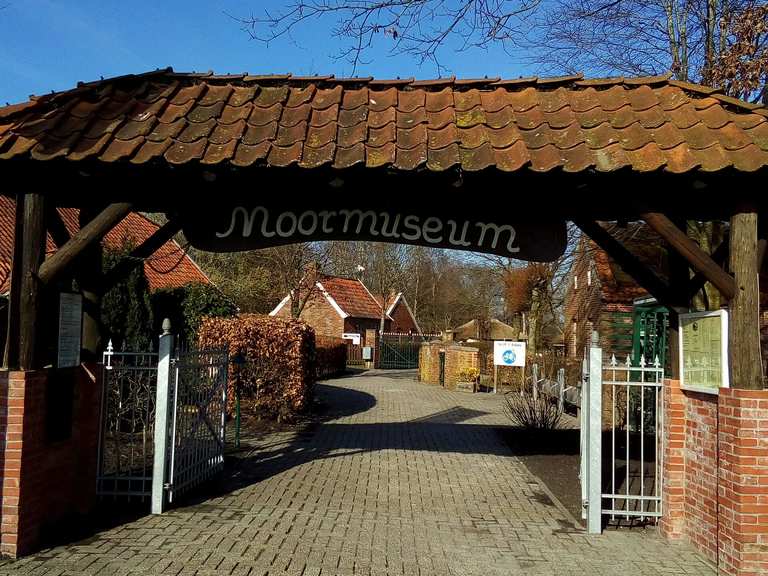
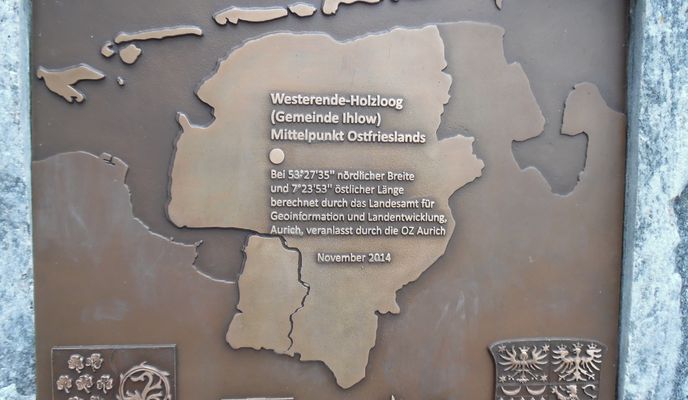
Eine gemütliche Rundfahrt von Moorhusen zum Großen Meer. Dort gibt es die Möglichkeit am Sandstrand zu baden oder auf dem durchschnittlich nur 90 cm tiefen See Tretboot zu fahren oder zu Surfen. Es gibt auch ein Restaurant, um sich für den Rückweg zu stärken. Dieser führt über den geographischen Mittelpunkt Ostfrieslands vorbei am Moormuseum in Moordorf und am Dörpmuseum in Münkeboe, die beide einen Besuch wert sind.
- -:--
- Duration
- 40.8 km
- Distance
- 0 m
- Ascent
- 0 m
- Descent
- ---
- Avg. speed
- ---
- Avg. speed
Route photos
Route quality
Waytypes & surfaces along the route
Waytypes
Path
20.7 km
(51 %)
Quiet road
14.2 km
(35 %)
Surfaces
Paved
35.9 km
(88 %)
Unpaved
1.9 km
(5 %)
Paving stones
19.7 km
(48 %)
Asphalt
16 km
(39 %)
Route highlights
Points of interest along the route
Point of interest after 16 km
Restaurant "Meerwarthaus Ubben" Telefon: 04942 3170
Accommodation after 16.1 km
Landhaus Großes Meer https://www.hlgm.de/

Point of interest after 33 km
Moormuseum Moordorf

Point of interest after 39 km
Dörpmuseum Münkeboe
Continue with Bikemap
Use, edit, or download this cycling route
You would like to ride Moorhusen - Großes Meer or customize it for your own trip? Here is what you can do with this Bikemap route:
Free features
- Save this route as favorite or in collections
- Copy & plan your own version of this route
- Sync your route with Garmin or Wahoo
Premium features
Free trial for 3 days, or one-time payment. More about Bikemap Premium.
- Navigate this route on iOS & Android
- Export a GPX / KML file of this route
- Create your custom printout (try it for free)
- Download this route for offline navigation
Discover more Premium features.
Get Bikemap PremiumFrom our community
Other popular routes starting in Rechtsupweg
 Nadörst, Treidelpad/Rundtour 8
- Distance
- 35.9 km
- Ascent
- 32 m
- Descent
- 34 m
- Location
- Rechtsupweg, Lower Saxony, Germany
 Tannenhausen/Rundtour 3
- Distance
- 30.4 km
- Ascent
- 16 m
- Descent
- 16 m
- Location
- Rechtsupweg, Lower Saxony, Germany
 Rahe, Upstalsboom, Rundtour 1
- Distance
- 31.7 km
- Ascent
- 0 m
- Descent
- 0 m
- Location
- Rechtsupweg, Lower Saxony, Germany
 Großheide/Rundtour 1
- Distance
- 26.9 km
- Ascent
- 13 m
- Descent
- 13 m
- Location
- Rechtsupweg, Lower Saxony, Germany
 Halbemond/Rundtour 1
- Distance
- 16.3 km
- Ascent
- 0 m
- Descent
- 0 m
- Location
- Rechtsupweg, Lower Saxony, Germany
 Lütetsburger Wald/Rundtour 1
- Distance
- 33.4 km
- Ascent
- 33 m
- Descent
- 35 m
- Location
- Rechtsupweg, Lower Saxony, Germany
 Großheide/Rundtour 2
- Distance
- 21.7 km
- Ascent
- 15 m
- Descent
- 17 m
- Location
- Rechtsupweg, Lower Saxony, Germany
 Rechtsupweg, Baumstraße 28 (über Westermoordorf)
- Distance
- 15.7 km
- Ascent
- 0 m
- Descent
- 0 m
- Location
- Rechtsupweg, Lower Saxony, Germany
Open it in the app


