

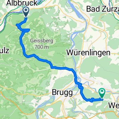
4-Albbruck-Koblenz
A cycling route starting in Schwaderloch, Canton of Aargau, Switzerland.
Overview
About this route
- -:--
- Duration
- 10.4 km
- Distance
- 35 m
- Ascent
- 24 m
- Descent
- ---
- Avg. speed
- ---
- Max. altitude
Route quality
Waytypes & surfaces along the route
Waytypes
Track
5.3 km
(51 %)
Quiet road
3 km
(29 %)
Surfaces
Paved
6.8 km
(66 %)
Unpaved
3.5 km
(34 %)
Asphalt
6.8 km
(66 %)
Gravel
3.5 km
(34 %)
Undefined
0.1 km
(<1 %)
Continue with Bikemap
Use, edit, or download this cycling route
You would like to ride 4-Albbruck-Koblenz or customize it for your own trip? Here is what you can do with this Bikemap route:
Free features
- Save this route as favorite or in collections
- Copy & plan your own version of this route
- Sync your route with Garmin or Wahoo
Premium features
Free trial for 3 days, or one-time payment. More about Bikemap Premium.
- Navigate this route on iOS & Android
- Export a GPX / KML file of this route
- Create your custom printout (try it for free)
- Download this route for offline navigation
Discover more Premium features.
Get Bikemap PremiumFrom our community
Other popular routes starting in Schwaderloch
 De Landstrasse 1362, Mettauertal à Kaltenbacherstrasse 4, Stein am Rhein
- Distance
- 76.9 km
- Ascent
- 642 m
- Descent
- 532 m
- Location
- Schwaderloch, Canton of Aargau, Switzerland
 Lange Ausfahrt durch Albbruck
- Distance
- 31.8 km
- Ascent
- 104 m
- Descent
- 103 m
- Location
- Schwaderloch, Canton of Aargau, Switzerland
 Sennhof 366, Schwaderloch nach Münzlishausenstrasse 7, Baden
- Distance
- 25.1 km
- Ascent
- 511 m
- Descent
- 426 m
- Location
- Schwaderloch, Canton of Aargau, Switzerland
 Route nach Mettauerberg 3287.1, Mettau
- Distance
- 3.3 km
- Ascent
- 129 m
- Descent
- 64 m
- Location
- Schwaderloch, Canton of Aargau, Switzerland
 Albrucht onwards
- Distance
- 52.8 km
- Ascent
- 395 m
- Descent
- 345 m
- Location
- Schwaderloch, Canton of Aargau, Switzerland
 15_07_16 - Albtal/Wehratal + Dinkelberg
- Distance
- 93.1 km
- Ascent
- 981 m
- Descent
- 1,029 m
- Location
- Schwaderloch, Canton of Aargau, Switzerland
 Bad Säckingen
- Distance
- 57.1 km
- Ascent
- 1,248 m
- Descent
- 1,245 m
- Location
- Schwaderloch, Canton of Aargau, Switzerland
 Albtal - Tiergrüble - Panoramastraße 2
- Distance
- 81 km
- Ascent
- 1,633 m
- Descent
- 1,688 m
- Location
- Schwaderloch, Canton of Aargau, Switzerland
Open it in the app