

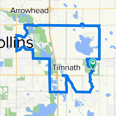
Pheasant run park
A cycling route starting in Windsor, Colorado, United States.
Overview
About this route
- -:--
- Duration
- 22 km
- Distance
- 55 m
- Ascent
- 64 m
- Descent
- ---
- Avg. speed
- ---
- Max. altitude
Continue with Bikemap
Use, edit, or download this cycling route
You would like to ride Pheasant run park or customize it for your own trip? Here is what you can do with this Bikemap route:
Free features
- Save this route as favorite or in collections
- Copy & plan your own version of this route
- Sync your route with Garmin or Wahoo
Premium features
Free trial for 3 days, or one-time payment. More about Bikemap Premium.
- Navigate this route on iOS & Android
- Export a GPX / KML file of this route
- Create your custom printout (try it for free)
- Download this route for offline navigation
Discover more Premium features.
Get Bikemap PremiumFrom our community
Other popular routes starting in Windsor
 poudre river loop
- Distance
- 25.5 km
- Ascent
- 185 m
- Descent
- 188 m
- Location
- Windsor, Colorado, United States
 Windsor Loop
- Distance
- 17.3 km
- Ascent
- 45 m
- Descent
- 45 m
- Location
- Windsor, Colorado, United States
 Steady ride in Fort Collins
- Distance
- 17.2 km
- Ascent
- 79 m
- Descent
- 92 m
- Location
- Windsor, Colorado, United States
 Moderate route in Fort Collins
- Distance
- 11.6 km
- Ascent
- 64 m
- Descent
- 36 m
- Location
- Windsor, Colorado, United States
 Walnut to Beerwerks
- Distance
- 12.2 km
- Ascent
- 39 m
- Descent
- 15 m
- Location
- Windsor, Colorado, United States
 Steamboat Ralleye
- Distance
- 313.5 km
- Ascent
- 3,800 m
- Descent
- 3,240 m
- Location
- Windsor, Colorado, United States
 Horizon Ridge Drive 4605, Windsor to Horizon Ridge Drive 4605, Windsor
- Distance
- 68.9 km
- Ascent
- 155 m
- Descent
- 141 m
- Location
- Windsor, Colorado, United States
 Harmony Club to East Fort Collins Loop
- Distance
- 34.9 km
- Ascent
- 149 m
- Descent
- 148 m
- Location
- Windsor, Colorado, United States
Open it in the app