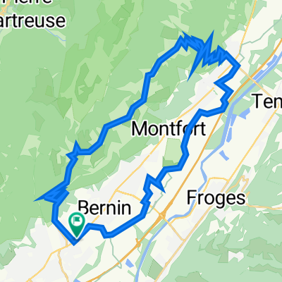
St Nazaire les Eymes - Tour de la Chartreuse
A cycling route starting in Saint-Nazaire-les-Eymes, Auvergne-Rh么ne-Alpes, France.
Overview
About this route
Cols du Coq, Cucheron, La Clusaz, Granier, Marcieux
- -:--
- Duration
- 107.1 km
- Distance
- 2,820 m
- Ascent
- 2,818 m
- Descent
- ---
- Avg. speed
- ---
- Max. altitude
Route quality
Waytypes & surfaces along the route
Waytypes
Road
40.7 km
(38 %)
Quiet road
6.4 km
(6 %)
Surfaces
Paved
60 km
(56 %)
Asphalt
60 km
(56 %)
Undefined
47.1 km
(44 %)
Continue with Bikemap
Use, edit, or download this cycling route
You would like to ride St Nazaire les Eymes - Tour de la Chartreuse or customize it for your own trip? Here is what you can do with this Bikemap route:
Free features
- Save this route as favorite or in collections
- Copy & plan your own version of this route
- Split it into stages to create a multi-day tour
- Sync your route with Garmin or Wahoo
Premium features
Free trial for 3 days, or one-time payment. More about Bikemap Premium.
- Navigate this route on iOS & Android
- Export a GPX / KML file of this route
- Create your custom printout (try it for free)
- Download this route for offline navigation
Discover more Premium features.
Get Bikemap PremiumFrom our community
Other popular routes starting in Saint-Nazaire-les-Eymes
- les petites roches JC
- Distance
- 35.8 km
- Ascent
- 944 m
- Descent
- 944 m
- Location
- Saint-Nazaire-les-Eymes, Auvergne-Rh么ne-Alpes, France
- St Nazaire les Eymes - Tour de la Chartreuse
- Distance
- 107.1 km
- Ascent
- 2,820 m
- Descent
- 2,818 m
- Location
- Saint-Nazaire-les-Eymes, Auvergne-Rh么ne-Alpes, France
- Chartreuse rit 5: Pr茅 de l'Arc
- Distance
- 54 km
- Ascent
- 1,562 m
- Descent
- 1,560 m
- Location
- Saint-Nazaire-les-Eymes, Auvergne-Rh么ne-Alpes, France
- ENLACE GRENOBLE-VALENCE POR LAS GORGES DE NAN
- Distance
- 154.8 km
- Ascent
- 1,312 m
- Descent
- 1,401 m
- Location
- Saint-Nazaire-les-Eymes, Auvergne-Rh么ne-Alpes, France
- etap1
- Distance
- 173.5 km
- Ascent
- 3,557 m
- Descent
- 3,345 m
- Location
- Saint-Nazaire-les-Eymes, Auvergne-Rh么ne-Alpes, France
- Chartreuse rit 2: Col de la Charmette
- Distance
- 68.9 km
- Ascent
- 1,980 m
- Descent
- 1,987 m
- Location
- Saint-Nazaire-les-Eymes, Auvergne-Rh么ne-Alpes, France
- Chartreuse rit 6: Rondje Nationaal Park
- Distance
- 86 km
- Ascent
- 2,380 m
- Descent
- 2,378 m
- Location
- Saint-Nazaire-les-Eymes, Auvergne-Rh么ne-Alpes, France
- Chartreuse rit 4: Col du Coq & Col de Porte
- Distance
- 51 km
- Ascent
- 1,778 m
- Descent
- 1,779 m
- Location
- Saint-Nazaire-les-Eymes, Auvergne-Rh么ne-Alpes, France
Open it in the app