

Lac Carouge - Hurtières - Bauges
A cycling route starting in Coise, Auvergne-Rhône-Alpes, France.
Overview
About this route
Mountain passes of Champ-Laurent, Grand Cucheron, du Frène, des Prés, de Marocaz
- -:--
- Duration
- 124.6 km
- Distance
- 2,409 m
- Ascent
- 2,407 m
- Descent
- ---
- Avg. speed
- ---
- Max. altitude

Route quality
Waytypes & surfaces along the route
Waytypes
Road
52.3 km
(42 %)
Quiet road
6.2 km
(5 %)
Undefined
66 km
(53 %)
Surfaces
Paved
108.4 km
(87 %)
Asphalt
108.4 km
(87 %)
Undefined
16.2 km
(13 %)
Continue with Bikemap
Use, edit, or download this cycling route
You would like to ride Lac Carouge - Hurtières - Bauges or customize it for your own trip? Here is what you can do with this Bikemap route:
Free features
- Save this route as favorite or in collections
- Copy & plan your own version of this route
- Split it into stages to create a multi-day tour
- Sync your route with Garmin or Wahoo
Premium features
Free trial for 3 days, or one-time payment. More about Bikemap Premium.
- Navigate this route on iOS & Android
- Export a GPX / KML file of this route
- Create your custom printout (try it for free)
- Download this route for offline navigation
Discover more Premium features.
Get Bikemap PremiumFrom our community
Other popular routes starting in Coise
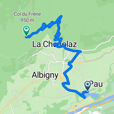 Col du Frêne - from camping Lac de Carouge
- Distance
- 10.8 km
- Ascent
- 796 m
- Descent
- 132 m
- Location
- Coise, Auvergne-Rhône-Alpes, France
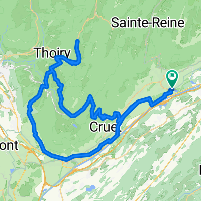
 Marocaz-Prés-Margériaz
- Distance
- 80.8 km
- Ascent
- 1,958 m
- Descent
- 1,958 m
- Location
- Coise, Auvergne-Rhône-Alpes, France
 Col de Prés and Col de Marocaz - From Lac de Carouge
- Distance
- 63.2 km
- Ascent
- 1,541 m
- Descent
- 1,541 m
- Location
- Coise, Auvergne-Rhône-Alpes, France
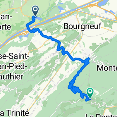 From Saint-Pierre-d'Albigny to Champ-Laurent
- Distance
- 18.7 km
- Ascent
- 1,073 m
- Descent
- 252 m
- Location
- Coise, Auvergne-Rhône-Alpes, France
 Europa Tour cz.2 26 Saint Pierre d'Albigny - Cerrelaz
- Distance
- 147 km
- Ascent
- ---
- Descent
- ---
- Location
- Coise, Auvergne-Rhône-Alpes, France
 route 6a dag 6 st pierre d albigny - bourg (solo track)
- Distance
- 101.8 km
- Ascent
- 740 m
- Descent
- 306 m
- Location
- Coise, Auvergne-Rhône-Alpes, France
 3.Etappe (Betton-Grenoble)
- Distance
- 64.4 km
- Ascent
- 369 m
- Descent
- 444 m
- Location
- Coise, Auvergne-Rhône-Alpes, France
 Lac Carouge - Hurtières - Bauges
- Distance
- 124.6 km
- Ascent
- 2,409 m
- Descent
- 2,407 m
- Location
- Coise, Auvergne-Rhône-Alpes, France
Open it in the app