

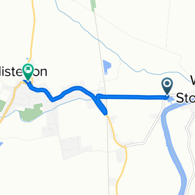
Long Monday Route In Doncaster
A cycling route starting in Misterton, England, United Kingdom.
Overview
About this route
- 1 h 9 min
- Duration
- 14 km
- Distance
- 55 m
- Ascent
- 60 m
- Descent
- 12.2 km/h
- Avg. speed
- ---
- Max. altitude

Route quality
Waytypes & surfaces along the route
Waytypes
Quiet road
5.2 km
(37 %)
Road
0.3 km
(2 %)
Undefined
8.5 km
(61 %)
Continue with Bikemap
Use, edit, or download this cycling route
You would like to ride Long Monday Route In Doncaster or customize it for your own trip? Here is what you can do with this Bikemap route:
Free features
- Save this route as favorite or in collections
- Copy & plan your own version of this route
- Sync your route with Garmin or Wahoo
Premium features
Free trial for 3 days, or one-time payment. More about Bikemap Premium.
- Navigate this route on iOS & Android
- Export a GPX / KML file of this route
- Create your custom printout (try it for free)
- Download this route for offline navigation
Discover more Premium features.
Get Bikemap PremiumFrom our community
Other popular routes starting in Misterton
 Wiseton Road, Clayworth, Retford to 1 Hall Cottages, Town St, Retford
- Distance
- 40 km
- Ascent
- 84 m
- Descent
- 73 m
- Location
- Misterton, England, United Kingdom
 Clayworth Hall, Church Lane, Retford to 4–6 Church Lane, Clayworth, Retford
- Distance
- 17.3 km
- Ascent
- 59 m
- Descent
- 75 m
- Location
- Misterton, England, United Kingdom
 Long Monday Route In Doncaster
- Distance
- 14 km
- Ascent
- 55 m
- Descent
- 60 m
- Location
- Misterton, England, United Kingdom
 The Old Rectory, Wiseton Road, Retford to 21 The Glebe, Retford
- Distance
- 13.4 km
- Ascent
- 0 m
- Descent
- 22 m
- Location
- Misterton, England, United Kingdom
 home to Langsett
- Distance
- 70.6 km
- Ascent
- 819 m
- Descent
- 569 m
- Location
- Misterton, England, United Kingdom
 Clayworth Hall, Church Lane, Retford to Clayworth Hall, Church Lane, Retford
- Distance
- 39.9 km
- Ascent
- 114 m
- Descent
- 115 m
- Location
- Misterton, England, United Kingdom
 Chesterfield Canal Wiserton to Trent
- Distance
- 10.5 km
- Ascent
- 22 m
- Descent
- 34 m
- Location
- Misterton, England, United Kingdom
 53.443° N -0.820° W to 2 Church St, Doncaster
- Distance
- 2.8 km
- Ascent
- 24 m
- Descent
- 0 m
- Location
- Misterton, England, United Kingdom
Open it in the app