

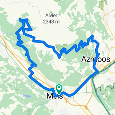
Sargans-Albula-St.Moritz 125km, 2950hm
A cycling route starting in Sargans, Canton of St. Gallen, Switzerland.
Overview
About this route
Sargans-Albula-St.Moritz 125km, 2950hm
- -:--
- Duration
- 124.5 km
- Distance
- 2,574 m
- Ascent
- 1,216 m
- Descent
- ---
- Avg. speed
- ---
- Max. altitude

Route quality
Waytypes & surfaces along the route
Waytypes
Road
34.9 km
(28 %)
Quiet road
24.9 km
(20 %)
Surfaces
Paved
83.4 km
(67 %)
Unpaved
27.4 km
(22 %)
Asphalt
80.9 km
(65 %)
Gravel
10 km
(8 %)
Continue with Bikemap
Use, edit, or download this cycling route
You would like to ride Sargans-Albula-St.Moritz 125km, 2950hm or customize it for your own trip? Here is what you can do with this Bikemap route:
Free features
- Save this route as favorite or in collections
- Copy & plan your own version of this route
- Split it into stages to create a multi-day tour
- Sync your route with Garmin or Wahoo
Premium features
Free trial for 3 days, or one-time payment. More about Bikemap Premium.
- Navigate this route on iOS & Android
- Export a GPX / KML file of this route
- Create your custom printout (try it for free)
- Download this route for offline navigation
Discover more Premium features.
Get Bikemap PremiumFrom our community
Other popular routes starting in Sargans
 MOUNTAINBIKE-TOUR "FEIERABENDERLEBNIS"
- Distance
- 17 km
- Ascent
- 747 m
- Descent
- 737 m
- Location
- Sargans, Canton of St. Gallen, Switzerland
 Swiss Trekking 1
- Distance
- 19.2 km
- Ascent
- 1,457 m
- Descent
- 1,454 m
- Location
- Sargans, Canton of St. Gallen, Switzerland
 Gonzen DH
- Distance
- 26.3 km
- Ascent
- 1,322 m
- Descent
- 1,320 m
- Location
- Sargans, Canton of St. Gallen, Switzerland
 Wangs Bad Ragaz Targön Schönbühl Wangs
- Distance
- 25.7 km
- Ascent
- 1,238 m
- Descent
- 1,188 m
- Location
- Sargans, Canton of St. Gallen, Switzerland
 Palfris
- Distance
- 44.4 km
- Ascent
- 1,340 m
- Descent
- 1,339 m
- Location
- Sargans, Canton of St. Gallen, Switzerland
 St. Luziasteig
- Distance
- 26.4 km
- Ascent
- 326 m
- Descent
- 321 m
- Location
- Sargans, Canton of St. Gallen, Switzerland
 Sargans-Pfäfers-Mapragg-Taminabrücke-Sargans
- Distance
- 48.1 km
- Ascent
- 1,018 m
- Descent
- 1,010 m
- Location
- Sargans, Canton of St. Gallen, Switzerland
 Trek Vélo N°2
- Distance
- 336.2 km
- Ascent
- 643 m
- Descent
- 551 m
- Location
- Sargans, Canton of St. Gallen, Switzerland
Open it in the app