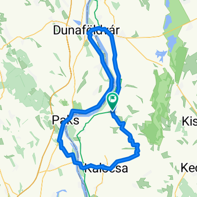
NAOS 180704 Szlidito Petofi
A cycling route starting in Dunapataj, Bács-Kiskun county, Hungary.
Overview
About this route
- -:--
- Duration
- 63.2 km
- Distance
- 25 m
- Ascent
- 28 m
- Descent
- ---
- Avg. speed
- ---
- Max. altitude
Route quality
Waytypes & surfaces along the route
Waytypes
Access road
24.6 km
(39 %)
Track
13.3 km
(21 %)
Surfaces
Paved
41.1 km
(65 %)
Unpaved
5.7 km
(9 %)
Asphalt
34.7 km
(55 %)
Concrete
6.3 km
(10 %)
Continue with Bikemap
Use, edit, or download this cycling route
You would like to ride NAOS 180704 Szlidito Petofi or customize it for your own trip? Here is what you can do with this Bikemap route:
Free features
- Save this route as favorite or in collections
- Copy & plan your own version of this route
- Sync your route with Garmin or Wahoo
Premium features
Free trial for 3 days, or one-time payment. More about Bikemap Premium.
- Navigate this route on iOS & Android
- Export a GPX / KML file of this route
- Create your custom printout (try it for free)
- Download this route for offline navigation
Discover more Premium features.
Get Bikemap PremiumFrom our community
Other popular routes starting in Dunapataj
- Hartai út 36, Dunapataj - Hartai út 36, Dunapataj
- Distance
- 24.2 km
- Ascent
- 16 m
- Descent
- 63 m
- Location
- Dunapataj, Bács-Kiskun county, Hungary
- A Duna mellett
- Distance
- 14.7 km
- Ascent
- 9 m
- Descent
- 9 m
- Location
- Dunapataj, Bács-Kiskun county, Hungary
- Dunapataj-Horvátország
- Distance
- 113.1 km
- Ascent
- 60 m
- Descent
- 66 m
- Location
- Dunapataj, Bács-Kiskun county, Hungary
- Szelidi-tó - Kecskemét
- Distance
- 92.3 km
- Ascent
- 136 m
- Descent
- 120 m
- Location
- Dunapataj, Bács-Kiskun county, Hungary
- Kerékpárral Rockmaratonra 2.nap
- Distance
- 168.7 km
- Ascent
- 229 m
- Descent
- 157 m
- Location
- Dunapataj, Bács-Kiskun county, Hungary
- 2011_Sofia-Budapest_08
- Distance
- 99.6 km
- Ascent
- 32 m
- Descent
- 14 m
- Location
- Dunapataj, Bács-Kiskun county, Hungary
- 3. nap:hétfő Szelidi tó - Baja
- Distance
- 66.5 km
- Ascent
- 20 m
- Descent
- 18 m
- Location
- Dunapataj, Bács-Kiskun county, Hungary
- Alsódunamente 4. nap
- Distance
- 63.8 km
- Ascent
- 36 m
- Descent
- 36 m
- Location
- Dunapataj, Bács-Kiskun county, Hungary
Open it in the app