

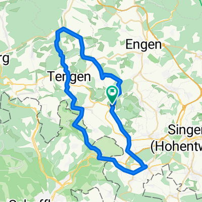
Binningen - Leipferdingen - Tengen - Bibertal - Gottmadingen - Binningen
A cycling route starting in Hilzingen, Baden-Württemberg, Germany.
Overview
About this route
- -:--
- Duration
- 47.1 km
- Distance
- 538 m
- Ascent
- 538 m
- Descent
- ---
- Avg. speed
- ---
- Max. altitude
Route quality
Waytypes & surfaces along the route
Waytypes
Road
21.2 km
(45 %)
Quiet road
10.9 km
(23 %)
Surfaces
Paved
35 km
(74 %)
Unpaved
1.6 km
(3 %)
Asphalt
33.1 km
(70 %)
Paved (undefined)
1.9 km
(4 %)
Continue with Bikemap
Use, edit, or download this cycling route
You would like to ride Binningen - Leipferdingen - Tengen - Bibertal - Gottmadingen - Binningen or customize it for your own trip? Here is what you can do with this Bikemap route:
Free features
- Save this route as favorite or in collections
- Copy & plan your own version of this route
- Sync your route with Garmin or Wahoo
Premium features
Free trial for 3 days, or one-time payment. More about Bikemap Premium.
- Navigate this route on iOS & Android
- Export a GPX / KML file of this route
- Create your custom printout (try it for free)
- Download this route for offline navigation
Discover more Premium features.
Get Bikemap PremiumFrom our community
Other popular routes starting in Hilzingen
 Binningen - Höri - Binningen
- Distance
- 67.9 km
- Ascent
- 317 m
- Descent
- 317 m
- Location
- Hilzingen, Baden-Württemberg, Germany
 Nordseite des Schienerberges
- Distance
- 51.6 km
- Ascent
- 1,121 m
- Descent
- 1,121 m
- Location
- Hilzingen, Baden-Württemberg, Germany
 Rhein, See, Seerücken und Höri
- Distance
- 104.6 km
- Ascent
- 1,143 m
- Descent
- 1,177 m
- Location
- Hilzingen, Baden-Württemberg, Germany
 Um den Hohenstoffeln (kleine Tour)
- Distance
- 16.4 km
- Ascent
- 190 m
- Descent
- 148 m
- Location
- Hilzingen, Baden-Württemberg, Germany
 Hilzingen, Wutachtal, Schwarzwaldpanoramastraße, Klettgau, Rhein CLONED FROM ROUTE 111674
- Distance
- 142.6 km
- Ascent
- 1,261 m
- Descent
- 1,261 m
- Location
- Hilzingen, Baden-Württemberg, Germany
 Der heilige Kral
- Distance
- 63.8 km
- Ascent
- 969 m
- Descent
- 969 m
- Location
- Hilzingen, Baden-Württemberg, Germany
 Kleine Rundtour
- Distance
- 25 km
- Ascent
- 300 m
- Descent
- 278 m
- Location
- Hilzingen, Baden-Württemberg, Germany
 Binningen - Leipferdingen - Tengen - Bibertal - Gottmadingen - Binningen
- Distance
- 47.1 km
- Ascent
- 538 m
- Descent
- 538 m
- Location
- Hilzingen, Baden-Württemberg, Germany
Open it in the app