

Anfahrt ohne Vignette (Bike Park Pohorje)
A cycling route starting in Šentilj, Občina Šentilj, Slovenia.
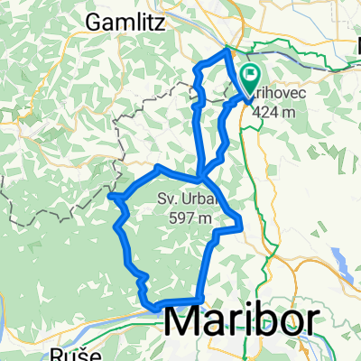
Overview
About this route
- -:--
- Duration
- 26.6 km
- Distance
- 181 m
- Ascent
- 108 m
- Descent
- ---
- Avg. speed
- ---
- Max. altitude

Route quality
Waytypes & surfaces along the route
Waytypes
Road
4.5 km
(17 %)
Cycleway
3.5 km
(13 %)
Surfaces
Paved
21.5 km
(81 %)
Asphalt
21.5 km
(81 %)
Undefined
5.1 km
(19 %)
Continue with Bikemap
Use, edit, or download this cycling route
You would like to ride Anfahrt ohne Vignette (Bike Park Pohorje) or customize it for your own trip? Here is what you can do with this Bikemap route:
Free features
- Save this route as favorite or in collections
- Copy & plan your own version of this route
- Sync your route with Garmin or Wahoo
Premium features
Free trial for 3 days, or one-time payment. More about Bikemap Premium.
- Navigate this route on iOS & Android
- Export a GPX / KML file of this route
- Create your custom printout (try it for free)
- Download this route for offline navigation
Discover more Premium features.
Get Bikemap PremiumFrom our community
Other popular routes starting in Šentilj
 EV9 SI Alternative Route Šentilj - Sečovlje
- Distance
- 368.7 km
- Ascent
- 914 m
- Descent
- 1,181 m
- Location
- Šentilj, Občina Šentilj, Slovenia
 EuroVelo 9 - Baltic - Adriatic
- Distance
- 326.5 km
- Ascent
- 4,866 m
- Descent
- 5,135 m
- Location
- Šentilj, Občina Šentilj, Slovenia
 Šentilj-Svečina- Gaj nad MB- Jakob- Šentilj
- Distance
- 69.9 km
- Ascent
- 986 m
- Descent
- 988 m
- Location
- Šentilj, Občina Šentilj, Slovenia
 ŠENTILJ - SPIELFELD - LANDSCHA AN DER MUR - OBERRAKITSCH - EICHFELD - GOSDORF - MURECK - TRATE - SLADKI VRH - SELNICA OB MURI - ŠENTILJ
- Distance
- 53.7 km
- Ascent
- 293 m
- Descent
- 285 m
- Location
- Šentilj, Občina Šentilj, Slovenia
 Šentilj--Gaj-Kamnica-Šentilj 52km
- Distance
- 51.5 km
- Ascent
- 654 m
- Descent
- 637 m
- Location
- Šentilj, Občina Šentilj, Slovenia
 Anfahrt ohne Vignette (Bike Park Pohorje)
- Distance
- 26.6 km
- Ascent
- 181 m
- Descent
- 108 m
- Location
- Šentilj, Občina Šentilj, Slovenia
 Ceršak - "Kernöl kronometer"
- Distance
- 41.7 km
- Ascent
- 57 m
- Descent
- 170 m
- Location
- Šentilj, Občina Šentilj, Slovenia
 Jantarna - pot
- Distance
- 55.3 km
- Ascent
- 218 m
- Descent
- 211 m
- Location
- Šentilj, Občina Šentilj, Slovenia
Open it in the app