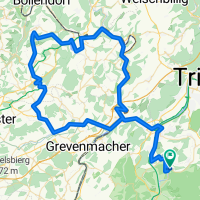
Hochwald 7
A cycling route starting in Wiltingen, Rhineland-Palatinate, Germany.
Overview
About this route
Route nur Sonntag morgtens befahrbar wegen Autoverkehr
- -:--
- Duration
- 78.6 km
- Distance
- 1,005 m
- Ascent
- 1,003 m
- Descent
- ---
- Avg. speed
- ---
- Avg. speed
Continue with Bikemap
Use, edit, or download this cycling route
You would like to ride Hochwald 7 or customize it for your own trip? Here is what you can do with this Bikemap route:
Free features
- Save this route as favorite or in collections
- Copy & plan your own version of this route
- Sync your route with Garmin or Wahoo
Premium features
Free trial for 3 days, or one-time payment. More about Bikemap Premium.
- Navigate this route on iOS & Android
- Export a GPX / KML file of this route
- Create your custom printout (try it for free)
- Download this route for offline navigation
Discover more Premium features.
Get Bikemap PremiumFrom our community
Other popular routes starting in Wiltingen
- Luxemburg 1
- Distance
- 98.1 km
- Ascent
- 1,035 m
- Descent
- 1,074 m
- Location
- Wiltingen, Rhineland-Palatinate, Germany
- Auf Probert 27, Wiltingen nach Im Winkel 7, Reil
- Distance
- 75.8 km
- Ascent
- 657 m
- Descent
- 715 m
- Location
- Wiltingen, Rhineland-Palatinate, Germany
- Mosel: Wiltingen - Mettlach
- Distance
- 88.5 km
- Ascent
- 417 m
- Descent
- 394 m
- Location
- Wiltingen, Rhineland-Palatinate, Germany
- Müllertal 2
- Distance
- 102.8 km
- Ascent
- 1,574 m
- Descent
- 1,602 m
- Location
- Wiltingen, Rhineland-Palatinate, Germany
- Ringstraße 9, Konz nach Ringstraße 9, Konz
- Distance
- 27.4 km
- Ascent
- 899 m
- Descent
- 915 m
- Location
- Wiltingen, Rhineland-Palatinate, Germany
- Luxemburg/Saargau
- Distance
- 75.9 km
- Ascent
- 744 m
- Descent
- 704 m
- Location
- Wiltingen, Rhineland-Palatinate, Germany
- Wiltingen > Trier Carl Benz Strasse
- Distance
- 24.6 km
- Ascent
- 85 m
- Descent
- 99 m
- Location
- Wiltingen, Rhineland-Palatinate, Germany
- Wiltingen > Saarburg > Könen > Grevenmacher > Mertert > Wasserbillig > Igel > Konz > Kanzem > Wiltingen
- Distance
- 60 km
- Ascent
- 143 m
- Descent
- 141 m
- Location
- Wiltingen, Rhineland-Palatinate, Germany
Open it in the app