

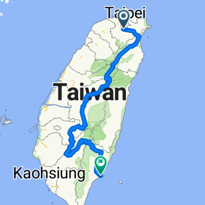
蘆洲Luzhou→貓空Maokong→蘆洲Luzhou
A cycling route starting in Banqiao District, Taipei, Taiwan.
Overview
About this route
Overview:
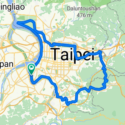
Luzhou District, New Taipei City (蘆洲) → Dadaocheng (大稻埕) → Maokong (貓空)
English Description:
Fortunately, over 95% of the road is designated bikeway, so there are nearly no vehicles. On the other hand, make sure to buy food or drinks at Maokong to have enough supplies, as there are no other places to purchase along the route. The scenery of Maokong is good, and there are lots of brunch restaurants and coffee shops. Many cycling teams have a coffee before heading home.
Chinese Description:
Over 95% of the route consists of bike paths, so there is almost no motorized traffic. However, this also means there are few places to buy food along the way, so remember to buy food and drinks at Maokong. The scenery of Maokong is pleasant, and there are many brunch spots and cafes. Many cycling teams stop there for coffee before going home.
Plus: if you use the GPX file on simple navigation bike head units like Garmin Edge 130 or Bryton 330 (which shows only one line on-screen during navigation and does not display detailed street maps; by the way, Bryton 330 is my bike head unit), you might possibly go the wrong way at checkpoints. Pay attention to the pictures on this page, as there are some red squares pointing you to the right direction. Check them before your ride and you'll be fine. I believe it is not possible to go the wrong way if using the Bikemap app or Garmin Edge 820, Garmin Edge 1000, or even higher-level units which show very detailed street maps on screen for navigation. Good luck! Feel free to contact me if you have any problem with navigation.
Supplement: If you use the GPX file with simple navigation bike computers like Garmin Edge 130 or Bryton 330, these units only display a simple line on screen without street map details (I use Bryton 330). Therefore, you might take a wrong turn! Check the red boxes in the photos on this page before departing and you should be fine. If you use the Bikemap app or Garmin Edge 820, 1000 or higher, it's very unlikely to go the wrong way. Good luck! If you have any questions about navigation, feel free to ask.
- -:--
- Duration
- 70.8 km
- Distance
- 350 m
- Ascent
- 351 m
- Descent
- ---
- Avg. speed
- ---
- Max. altitude

Route photos


Continue with Bikemap
Use, edit, or download this cycling route
You would like to ride 蘆洲Luzhou→貓空Maokong→蘆洲Luzhou or customize it for your own trip? Here is what you can do with this Bikemap route:
Free features
- Save this route as favorite or in collections
- Copy & plan your own version of this route
- Sync your route with Garmin or Wahoo
Premium features
Free trial for 3 days, or one-time payment. More about Bikemap Premium.
- Navigate this route on iOS & Android
- Export a GPX / KML file of this route
- Create your custom printout (try it for free)
- Download this route for offline navigation
Discover more Premium features.
Get Bikemap PremiumFrom our community
Other popular routes starting in Banqiao District
 中央山脈一條鞭
- Distance
- 690.1 km
- Ascent
- 8,446 m
- Descent
- 8,466 m
- Location
- Banqiao District, Taipei, Taiwan
 台北市一圈
台北市一圈- Distance
- 68.8 km
- Ascent
- 207 m
- Descent
- 211 m
- Location
- Banqiao District, Taipei, Taiwan
 新店-北宜-礁溪
- Distance
- 61.1 km
- Ascent
- 2,514 m
- Descent
- 2,331 m
- Location
- Banqiao District, Taipei, Taiwan
 板橋-觀音山
- Distance
- 22 km
- Ascent
- 413 m
- Descent
- 76 m
- Location
- Banqiao District, Taipei, Taiwan
 碧潭-獅子頭山
- Distance
- 12.1 km
- Ascent
- 704 m
- Descent
- 80 m
- Location
- Banqiao District, Taipei, Taiwan
 西濱-八仙to白沙屯
- Distance
- 104.3 km
- Ascent
- 132 m
- Descent
- 133 m
- Location
- Banqiao District, Taipei, Taiwan
 環大台北
環大台北- Distance
- 160.8 km
- Ascent
- 584 m
- Descent
- 576 m
- Location
- Banqiao District, Taipei, Taiwan
 三芝 巴拉卡
- Distance
- 75.1 km
- Ascent
- 1,019 m
- Descent
- 1,014 m
- Location
- Banqiao District, Taipei, Taiwan
Open it in the app