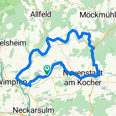
Bad Friedrichshall - Vöhringen
A cycling route starting in Oedheim, Baden-Wurttemberg, Germany.
Overview
About this route
Return route from Ingrid via Murrhardt, Schwäbisch Gmünd
- -:--
- Duration
- 190.4 km
- Distance
- 1,591 m
- Ascent
- 1,081 m
- Descent
- ---
- Avg. speed
- ---
- Max. altitude
Route quality
Waytypes & surfaces along the route
Waytypes
Quiet road
47.6 km
(25 %)
Road
45.7 km
(24 %)
Surfaces
Paved
148.5 km
(78 %)
Unpaved
11.4 km
(6 %)
Asphalt
139 km
(73 %)
Paved (undefined)
9.5 km
(5 %)
Continue with Bikemap
Use, edit, or download this cycling route
You would like to ride Bad Friedrichshall - Vöhringen or customize it for your own trip? Here is what you can do with this Bikemap route:
Free features
- Save this route as favorite or in collections
- Copy & plan your own version of this route
- Split it into stages to create a multi-day tour
- Sync your route with Garmin or Wahoo
Premium features
Free trial for 3 days, or one-time payment. More about Bikemap Premium.
- Navigate this route on iOS & Android
- Export a GPX / KML file of this route
- Create your custom printout (try it for free)
- Download this route for offline navigation
Discover more Premium features.
Get Bikemap PremiumFrom our community
Other popular routes starting in Oedheim
- Kocher Seckach Schefflenz
- Distance
- 71.8 km
- Ascent
- 920 m
- Descent
- 866 m
- Location
- Oedheim, Baden-Wurttemberg, Germany
- Oedheim - Karlsruhe
- Distance
- 80.2 km
- Ascent
- 386 m
- Descent
- 427 m
- Location
- Oedheim, Baden-Wurttemberg, Germany
- Tulpenweg 2, Oedheim nach Tulpenweg 2, Oedheim
- Distance
- 11.8 km
- Ascent
- 124 m
- Descent
- 122 m
- Location
- Oedheim, Baden-Wurttemberg, Germany
- Breitenauer See 001
- Distance
- 58.9 km
- Ascent
- 256 m
- Descent
- 256 m
- Location
- Oedheim, Baden-Wurttemberg, Germany
- Untergriesheim - Katzenbuckel
- Distance
- 77 km
- Ascent
- 705 m
- Descent
- 715 m
- Location
- Oedheim, Baden-Wurttemberg, Germany
- Untergriesheim-Jagstfeld-Neckarsulm-Dahenfeld-Neuenstadt-Oedheim
- Distance
- 38.4 km
- Ascent
- 279 m
- Descent
- 255 m
- Location
- Oedheim, Baden-Wurttemberg, Germany
- Recovered Route
- Distance
- 11 km
- Ascent
- 39 m
- Descent
- 59 m
- Location
- Oedheim, Baden-Wurttemberg, Germany
- Oedheim_nach_Neufels
- Distance
- 40.9 km
- Ascent
- 425 m
- Descent
- 249 m
- Location
- Oedheim, Baden-Wurttemberg, Germany
Open it in the app