

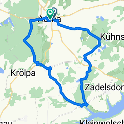
Auma - Leipzig (Süd)
A cycling route starting in Auma, Thuringia, Germany.
Overview
About this route
- -:--
- Duration
- 104.2 km
- Distance
- 383 m
- Ascent
- 654 m
- Descent
- ---
- Avg. speed
- 422 m
- Max. altitude
Route quality
Waytypes & surfaces along the route
Waytypes
Quiet road
12.5 km
(12 %)
Track
10.4 km
(10 %)
Surfaces
Paved
80.2 km
(77 %)
Unpaved
4.2 km
(4 %)
Asphalt
78.2 km
(75 %)
Ground
2.1 km
(2 %)
Continue with Bikemap
Use, edit, or download this cycling route
You would like to ride Auma - Leipzig (Süd) or customize it for your own trip? Here is what you can do with this Bikemap route:
Free features
- Save this route as favorite or in collections
- Copy & plan your own version of this route
- Split it into stages to create a multi-day tour
- Sync your route with Garmin or Wahoo
Premium features
Free trial for 3 days, or one-time payment. More about Bikemap Premium.
- Navigate this route on iOS & Android
- Export a GPX / KML file of this route
- Create your custom printout (try it for free)
- Download this route for offline navigation
Discover more Premium features.
Get Bikemap PremiumFrom our community
Other popular routes starting in Auma
 Hausrunde
- Distance
- 43 km
- Ascent
- 445 m
- Descent
- 447 m
- Location
- Auma, Thuringia, Germany
 Lange Radrunde durch Auma-Weidatal
- Distance
- 42.1 km
- Ascent
- 431 m
- Descent
- 431 m
- Location
- Auma, Thuringia, Germany
 Straße des Friedens 19, Auma-Weidatal nach Straße des Friedens 28, Auma-Weidatal
- Distance
- 19.5 km
- Ascent
- 470 m
- Descent
- 474 m
- Location
- Auma, Thuringia, Germany
 Auma - Leipzig (Süd)
- Distance
- 104.2 km
- Ascent
- 383 m
- Descent
- 654 m
- Location
- Auma, Thuringia, Germany
 Plötzen
- Distance
- 44.4 km
- Ascent
- 408 m
- Descent
- 409 m
- Location
- Auma, Thuringia, Germany
 Markt nach Kolbestraße
- Distance
- 16.9 km
- Ascent
- 254 m
- Descent
- 293 m
- Location
- Auma, Thuringia, Germany
 distanzritt
- Distance
- 29 km
- Ascent
- 398 m
- Descent
- 399 m
- Location
- Auma, Thuringia, Germany
 Auma - Sachswitz über Pöllwitz
- Distance
- 28.8 km
- Ascent
- 399 m
- Descent
- 476 m
- Location
- Auma, Thuringia, Germany
Open it in the app